Cycling

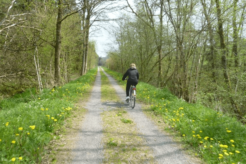
Pre-RAVeL of Line 618. From Assenois (Vaux-sur-Sûre) to Martelange

website: website: website: website: website: Owner/holder of the abandoned railway: The general legal framework in the Walloon Region is an emphyteutic lease between Wallonia and the SNCB, allowing the Walloon Region to use the former railways to develop greenways Owner/holder of the abandoned railway: The general legal framework in the Walloon Region is an emphyteutic lease between Wallonia and the SNCB, allowing the Walloon Region to use the former railways to develop greenways Owner/holder of the abandoned railway: Owner/holder of the abandoned railway: Owner/holder of the abandoned railway: more helpful hints Owner/holder of the abandoned railway: Owner/holder of the abandoned railway: The general legal framework in the Walloon Region is an emphyteutic lease between Wallonia and the SNCB, allowing the Walloon Region to use the former railways to develop greenways The general legal framework in the Walloon Region is an emphyteutic lease between Wallonia and the SNCB, allowing the Walloon Region to use the former railways to develop greenways The general legal framework in the Walloon Region is an emphyteutic lease between Wallonia and the SNCB, allowing the Walloon Region to use the former railways to develop greenways The general legal framework in the Walloon Region is an emphyteutic lease between Wallonia and the SNCB, allowing the Walloon Region to use the former railways to develop greenways The general legal framework in the Walloon Region is an emphyteutic lease between Wallonia and the SNCB, allowing the Walloon Region to use the former railways to develop greenways gpx file: gpx file: gpx file: gpx file: gpx file: This itinerary follows the old vicinal line 618, today developed into a pre-RAVeL between Assenois, the ponds of the Strange in Hompré and Martelange, in the province of Luxemburg in Begium, region of the Ardennes The “Pre-Ravel” goes through many villages in the Bastogne region, in the calm and idyllic setting of the Strange and Sûre valleys. It runs along the edge of the Strange ponds, between Hompré and Hollange, and will link its course to the meandering of the Sure river. Most of the route is in the Natura 2000 area, and the surrounding nature invites to enjoy outdoor and take a discovering and leisurely walk. Multiple educational totems along the way remind the origin of the line. On the territory of the municipality of Fauvillers, metal panels “Mémoire du Tram”, in the shape of the front of a locomotive, give the names of the old stops and local and historical information. This itinerary follows the old vicinal line 618, today developed into a pre-RAVeL between Assenois, the ponds of the Strange in Hompré and Martelange, in the province of Luxemburg in Begium, region of the Ardennes The “Pre-Ravel” goes through many villages in the Bastogne region, in the calm and idyllic setting of the Strange and Sûre valleys. It runs along the edge of the Strange ponds, between Hompré and Hollange, and will link its course to the meandering of the Sure river. Most of the route is in the Natura 2000 area, and the surrounding nature invites to enjoy outdoor and take a discovering and leisurely walk. Multiple educational totems along the way remind the origin of the line. On the territory of the municipality of Fauvillers, metal panels “Mémoire du Tram”, in the shape of the front of a locomotive, give the names of the old stops and local and historical information. Total distance: 21316 mTotal climbing: 556 mTotal descent: -436 m Total distance: 21316 m Total distance: 21316 m Total climbing: 556 m Total climbing: 556 m Total descent: -436 m Total descent: -436 m Very good connexions with sports equipment’s, namely the sports hall in Martelange is right nearby. Great diversity of natural and cultural assets, the greenway crosses a very beautiful & historically valuable rural area, the Ardennes region. It is right on the border of Luxembourg, which gives it a cross-border interest. Parc de la Haute-Sure/Foret d’Anlier: the area around the Maison du Parc invites to discover local ecosystems: signposted walks, recreational facilities, including the “bird walk” & the “biodiversity labyrinth Ardoise Museum Haut-Martelange: provides a complete overview of a mining industry that has shaped the region for 200 years. Bastogne War Museum. The main World War II memorial site in Belgium, with a focus on the Battle of the Ardennes. Considering the characteristics, the main activities are: c Potential users are cyclists, walkers, horse riders and; no information about people with reduced mobility. The route is already developed as Pre-Ravel. Improvement works are planned: development of the RAVeL between Radelange and Martelange (1 km). Stage: award of works. Potential users are cyclists, walkers, horse riders and; no information about people with reduced mobility. The route is already developed as Pre-Ravel. Improvement works are planned: development of the RAVeL between Radelange and Martelange (1 km). Stage: award of works. Potential users are cyclists, walkers, horse riders and; no information about people with reduced mobility. Potential users are c The route is already developed as Pre-Ravel. Improvement works are planned: development of the RAVeL between Radelange and Martelange (1 km). Stage: award of works.

Pre-RAVeL of Line 618. From Assenois (Vaux-sur-Sûre) to Martelange Read More »

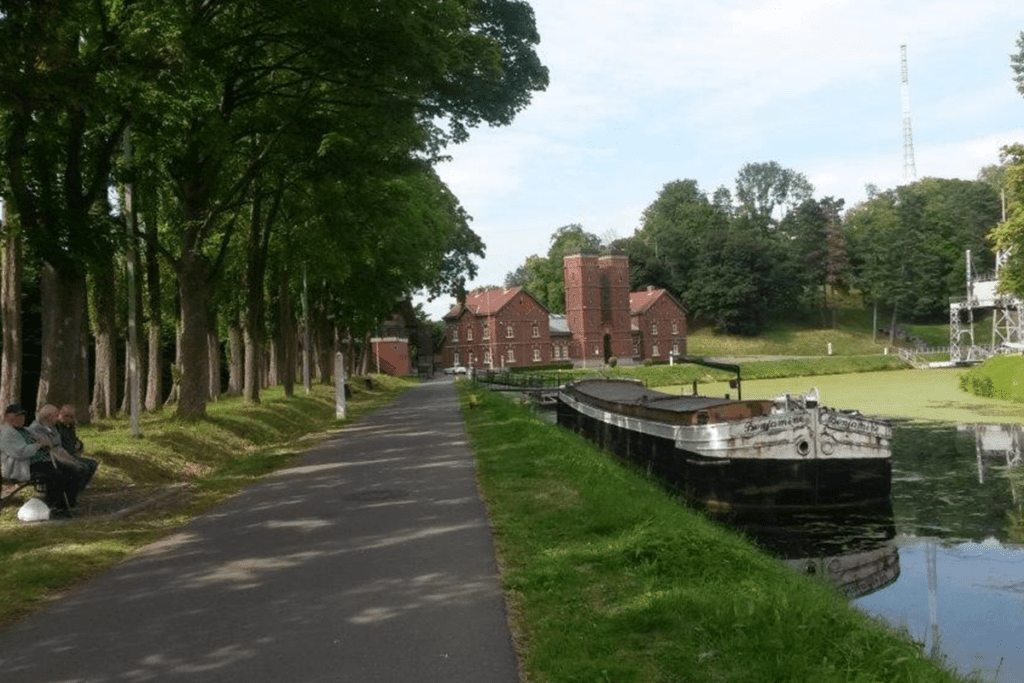
Lines 107 & 114 La Louvière station –Central Channel

website: / website: / website: website: website: website: offers on website: / / / / / Owner/holder of the abandoned railway: The general legal framework in the Walloon Region is an emphyteutic lease between Wallonia and the SNCB, allowing the Walloon Region to use the former railways to develop greenways Owner/holder of the abandoned railway: The general legal framework in the Walloon Region is an emphyteutic lease between Wallonia and the SNCB, allowing the Walloon Region to use the former railways to develop greenways Owner/holder of the abandoned railway: Owner/holder of the abandoned railway: Owner/holder of the abandoned railway: Owner/holder of the abandoned railway: Owner/holder of the abandoned railway: The general legal framework in the Walloon Region is an emphyteutic lease between Wallonia and the SNCB, allowing the Walloon Region to use the former railways to develop greenways The general legal framework in the Walloon Region is an emphyteutic lease between Wallonia and the SNCB, allowing the Walloon Region to use the former railways to develop greenways The general legal framework in the Walloon Region is an emphyteutic lease between Wallonia and the SNCB, allowing the Walloon Region to use the former railways to develop greenways The general legal framework in the Walloon Region is an emphyteutic lease between Wallonia and the SNCB, allowing the Walloon Region to use the former railways to develop greenways The general legal framework in the Walloon Region is an emphyteutic lease between Wallonia and the SNCB, allowing the Walloon Region to use the former railways to develop greenways gpx file: gpx file: gpx file: gpx file: gpx file: Total distance: 0 mTotal climbing: 0 mTotal descent: 0 m Total distance: 0 m Total distance: 0 m Total climbing: 0 m Total climbing: 0 m Total descent: 0 m Total descent: 0 m This greenway will allow to stablish a connexion with shops and sports centres. This will be a regional interchange node (train and bus station); a link with the schools will also be established. The Four Lifts on the Canal du Centre and their Environs, La Louvière and Le Roeulx (Hainaut) are a UNESCO World Heritage Site. The four hydraulic boat-lifts together with the canal itself and its associated structures, constitute a remarkably well-preserved and complete example of a late-19th-century industrial landscape. Located over a distance of 7 km, each one covering a change in level of 15 to 16 meters. They are the only ones in the world which still exist in their original working condition. Credits: EGWA Credits: EGWA Credits: EGWA Credits: EGWA Credits: EGWA Credits: EGWA Credits: EGWA Credits: EGWA Considering the characteristics, the main activities are: cycling, walking, jogging, horse riding, Considering the characteristics, the main activities are: cycling, walking, jogging, horse riding, Considering the characteristics, the main activities are: cycling, walking, jogging, horse riding, Considering the characteristics, the main activities are: c ycling, walking, jogging, horse riding, Credits: Walloon Region Credits: Walloon Region Credits: Walloon Region Credits: Walloon Region The potential users are cyclists, walkers, horse riders and, most likely, people with reduced mobility (to be confirmed upon completion of the pre-study), as usual  in the RAVel  -greenways.  There is a plan by Walloon Region for transforming this abandoned railway into a greenway. Stage: pre-study. The potential users are cyclists, walkers, horse riders and, most likely, people with reduced mobility (to be confirmed upon completion of the pre-study), as usual  in the RAVel  -greenways.  There is a plan by Walloon Region for transforming this abandoned railway into a greenway. Stage: pre-study. The potential users are cyclists, walkers, horse riders and, most likely, people with reduced mobility (to be confirmed upon completion of the pre-study), as usual  in the RAVel  -greenways.  The potential users are There is a plan by Walloon Region for transforming this abandoned railway into a greenway. Stage: pre-study. There is a plan by Walloon Region for transforming this abandoned railway into a greenway. Stage: pre-study.

Lines 107 & 114 La Louvière station –Central Channel Read More »

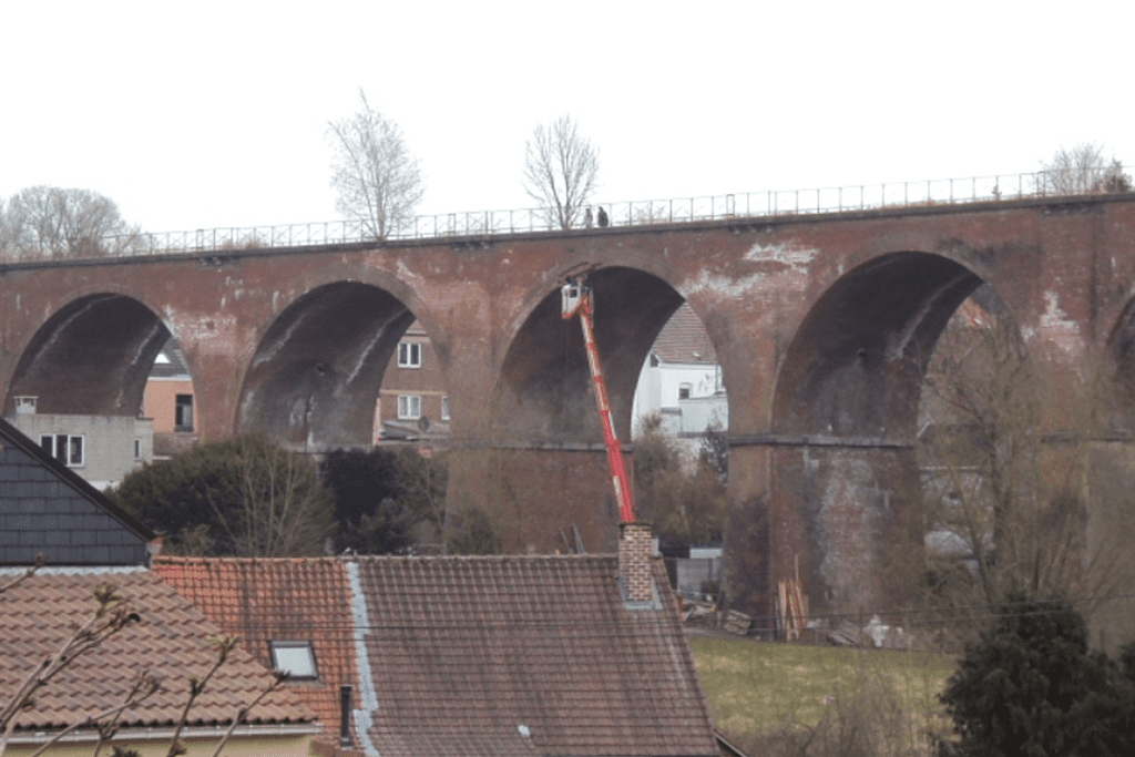
Line 115/2 Tubize-Braine l’Alleud

website: website: website: website: website: Owner/holder of the abandoned railway: Emphyteutic lease between Wallonia and the SNCB, allowing Walloon region to use the former railway line 115 Braine l’Alleud – Clabecq for the transformation of this line into a greenway. Owner/holder of the abandoned railway: Emphyteutic lease between Wallonia and the SNCB, allowing Walloon region to use the former railway line 115 Braine l’Alleud – Clabecq for the transformation of this line into a greenway. Owner/holder of the abandoned railway: Owner/holder of the abandoned railway: Owner/holder of the abandoned railway: Owner/holder of the abandoned railway: Owner/holder of the abandoned railway: Emphyteutic lease between Wallonia and the SNCB, allowing Walloon region to use the former railway line 115 Braine l’Alleud – Clabecq for the transformation of this line into a greenway. Emphyteutic lease between Wallonia and the SNCB, allowing Walloon region to use the former railway line 115 Braine l’Alleud – Clabecq for the transformation of this line into a greenway. Emphyteutic lease between Wallonia and the SNCB, allowing Walloon region to use the former railway line 115 Braine l’Alleud – Clabecq for the transformation of this line into a greenway. Emphyteutic lease between Wallonia and the SNCB, allowing Walloon region to use the former railway line 115 Braine l’Alleud – Clabecq for the transformation of this line into a greenway. Emphyteutic lease between Wallonia and the SNCB, allowing Walloon region to use the former railway line 115 Braine l’Alleud – Clabecq for the transformation of this line into a greenway. gpx file: gpx file: gpx file: gpx file: gpx file: Conversion of the former railway line 115 from Braine-l’Alleud to Clabecq via Braine-le-Château into a greenway (RAVeL as is named in Walloon region). Will connect with the RAVel on the Charleroi-Brussels canal, part of the regional cycle route network W3. Located in a Urban and suburban area. Work will include rehabilitation of the engineering structures (45) including the Estrée viaduct (brick bridge with 16 arches) and construction of the RAVeL- greenway (11.2km): asphalting over a width of 3m and a lateral bridleway. Intervention by the Walloon Region, the municipalities concerned and the Province of Walloon Brabant. This greenway is very important for soft modes of mobility as it links Braine l’Alleud station to the Hain area and further on to Clabecq and Tubize, avoiding the Tubize road which is very busy with traffic. Work on the RAVeL is in progress. Note: The map show an aapproximate itinerary, which will be detailed after the completion of the greenway. Conversion of the former railway line 115 from Braine-l’Alleud to Clabecq via Braine-le-Château into a greenway (RAVeL as is named in Walloon region). Will connect with the RAVel on the Charleroi-Brussels canal, part of the regional cycle route network W3. Located in a Urban and suburban area. Work will include rehabilitation of the engineering structures (45) including the Estrée viaduct (brick bridge with 16 arches) and construction of the RAVeL- greenway (11.2km): asphalting over a width of 3m and a lateral bridleway. Intervention by the Walloon Region, the municipalities concerned and the Province of Walloon Brabant. This greenway is very important for soft modes of mobility as it links Braine l’Alleud station to the Hain area and further on to Clabecq and Tubize, avoiding the Tubize road which is very busy with traffic. Work on the RAVeL is in progress. Note: The map show an aapproximate itinerary, which will be detailed after the completion of the greenway. Total distance: 0 mTotal climbing: 0 mTotal descent: 0 m Total distance: 0 m Total distance: 0 m Total climbing: 0 mTotal descent: 0 m Total climbing: 0 m basics Total climbing: 0 m Total descent: 0 m Total descent: 0 m Total descent: 0 m The potential of this future RAVeL is significant and very diversified; it will be the backbone of many safe rides & walks for children, families, less experienced cyclists, etc. Sports centres, schools, municipal administration premises, shops, etc. are close to this structuring greenway. Will avoid the crossroads of Mont-Saint-Pont, too dangerous in its current configuration. Will permit reaching companies located in the industrial zone by bike, Connection with the important communication node that is the SNCB and TEC Braine-l’Alleud station, which serves around ten destinations. Braine-l’Alleud) Credits: RAVel Wallon Region Credits: RAVel Wallon Region Credits: RAVel Wallon Region Credits: RAVel Wallon Region Credits: RAVel Wallon Region Credits: RAVel Wallon Region Credits: RAVel Wallon Region Credits: RAVel Wallon Region This greenway has been strongly demanded locally for sustainable mobility. The highest expected use  will be cycling for active mobility; it will be, as generally in greenways, suitable for cycling, walking, running, horse riding. This greenway has been strongly demanded locally for sustainable mobility. The highest expected use  will be cycling for active mobility; it will be, as generally in greenways, suitable for cycling, walking, running, horse riding. This greenway has been strongly demanded locally for sustainable mobility. The highest expected use  will be cycling for active mobility; it will be, as generally in greenways, suitable for cycling, walking, running, horse riding. Credits: EGWA; Base for the greenway drawing, RAVEL portal Credits: EGWA; Base for the greenway drawing, RAVEL portal Credits: EGWA; Base for the greenway drawing, RAVEL portal Credits: EGWA; Base for the greenway drawing, RAVEL portal Cyclists, walkers, horse riders and, most likely, people with reduced mobility (to be confirmed upon completion of the work), as usual  in the RAVel  -greenways. There is a plan for trasforming the abandoned railway into a greenway. Works are currently underway. The work is funded by the Walloon Region and the Province of Walloon Brabant is the contracting authority for this project. Cyclists, walkers, horse riders and, most likely, people with reduced mobility (to be confirmed upon completion of the work), as usual  in the RAVel  -greenways. There is a plan for trasforming the abandoned railway into a greenway. Works are currently underway. The work is funded by the Walloon Region and the Province of Walloon Brabant is the contracting authority for this

Line 115/2 Tubize-Braine l’Alleud Read More »

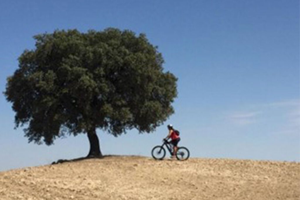
Alberche Greenway

website: website: website: website: website: Owner/holder of the abandoned railway: NOT KNOWN Owner/holder of the abandoned railway: NOT KNOWN Owner/holder of the abandoned railway: Owner/holder of the abandoned railway: Owner/holder of the abandoned railway: Owner/holder of the abandoned railway: Owner/holder of the abandoned railway: NOT KNOWN NOT KNOWN NOT KNOWN NOT KNOWN NOT KNOWN additional resources gpx file: gpx file: gpx file: gpx file: gpx file: It is one of the best routes for ease in the Madrid Region and for going permanently next to the water. It is a beautiful route, with water present all the way and with many bridges to cross. There are bridges and tunnels. It is one of the best routes for ease in the Madrid Region and for going permanently next to the water. It is a beautiful route, with water present all the way and with many bridges to cross. There are bridges and tunnels. It is one of the best routes for ease in the Madrid Region and for going permanently next to the water. It is a beautiful route, with water present all the way and with many bridges to cross. There are bridges and tunnels. Total distance: 14038 mTotal climbing: 377 mTotal descent: -378 m Total distance: 14038 m Total distance: 14038 m Total climbing: 377 m Total climbing: 377 m Total descent: -378 m Total descent: -378 m Point of interest: Picada Water Reservoir Intermodality: Car park available at the start of the path Point of interest: Picada Water Reservoir Intermodality: Car park available at the start of the path Point of interest: Picada Water Reservoir Point of interest: Intermodality: Car park available at the start of the path Intermodality Considering the characteristics, the main activities are: walking, running, cycling, horse riding, suitable for kids. Considering the characteristics, the main activities are: walking, running, cycling, horse riding, suitable for kids. Considering the characteristics, the main activities are: walking, running, cycling, horse riding, suitable for kids. Considering the characteristics, the main activities are: w alking, running, cycling, horse riding, suitable for kids. Potential users could be pedestrians, hikers, runners, horse riders. There are no plans for transforming this abandoned railway into a greenway. Potential users could be pedestrians, hikers, runners, horse riders. There are no plans for transforming this abandoned railway into a greenway. Potential users could be pedestrians, hikers, runners, horse riders. Potential users could be pedestrians, hikers, runners, horse riders. There are no plans for transforming this abandoned railway into a greenway. There are no plans for transforming this abandoned railway into a greenway.

Alberche Greenway Read More »

Old canal of Estremera

website: website: website: website: website: Owner/holder of the abandoned railway: Irrigation Community of the Estremera Canal & Tagus Hydrographic Confederation, Local municipalities Owner/holder of the abandoned railway: Irrigation Community of the Estremera Canal & Tagus Hydrographic Confederation, Local municipalities Owner/holder of the abandoned railway: Owner/holder of the abandoned railway: Owner/holder of the abandoned railway: Owner/holder of the abandoned railway: Owner/holder of the abandoned railway: Irrigation Community of the Estremera Canal & Tagus Hydrographic Confederation, Local municipalities Irrigation Community of the Estremera Canal & Tagus Hydrographic Confederation, Local municipalities Irrigation Community of the Estremera Canal & Tagus Hydrographic Confederation, Local municipalities Irrigation Community of the Estremera Canal & Tagus Hydrographic Confederation, Local municipalities Irrigation Community of the Estremera Canal & Tagus Hydrographic Confederation, Local municipalities gpx file: gpx file: gpx file: gpx file: gpx file: Flat territory which mainly runs alongside the old Estremera canal. It crosses the municipalities of Villamanrique de Tajo y Fuentidueña de Tajo. In some parts, users need to cross motorised roads. Flat territory which mainly runs alongside the old Estremera canal. It crosses the municipalities of Villamanrique de Tajo y Fuentidueña de Tajo. In some parts, users need to cross motorised roads. Flat territory which mainly runs alongside the old Estremera canal. It crosses the municipalities of Villamanrique de Tajo y Fuentidueña de Tajo. In some parts, users need to cross motorised roads. Total distance: 42503 mTotal climbing: 507 mTotal descent: -525 m Total distance: 42503 m Total distance: 42503 m Total climbing: 507 m Total climbing: 507 m / Total descent: -525 m Total descent: -525 m Points of interests: Piquillos Castle, Panoramic Viewpoint, Salobre Fountain, Cave Houses, Canal Aqueduct, Valdehondillo Stream, Castillejo Hill, Panoramic View of the Tagus, Irrigated Crops. Very close connection with the Tagus Nature Trail (Camino Natural del Tajo). Connection with Greenway: Tren de los 40 días Greenway and Tajuña Greenway. There are several usable tunnels are preserved in the Municipality of Estremera for the old 40-day train. Points of interests: Piquillos Castle, Panoramic Viewpoint, Salobre Fountain, Cave Houses, Canal Aqueduct, Valdehondillo Stream, Castillejo Hill, Panoramic View of the Tagus, Irrigated Crops. Very close connection with the Tagus Nature Trail (Camino Natural del Tajo). Connection with Greenway: Tren de los 40 días Greenway and Tajuña Greenway. There are several usable tunnels are preserved in the Municipality of Estremera for the old 40-day train. Points of interests: Piquillos Castle, Panoramic Viewpoint, Salobre Fountain, Cave Houses, Canal Aqueduct, Valdehondillo Stream, Castillejo Hill, Panoramic View of the Tagus, Irrigated Crops. Very close connection with the Tagus Nature Trail (Camino Natural del Tajo). Points of interests: Connection with Greenway: Tren de los 40 días Greenway and Tajuña Greenway. There are several usable tunnels are preserved in the Municipality of Estremera for the old 40-day train. Connection with Greenway: . Considering the characteristics, the main activities are: running, walking, hiking, cycling. Considering the characteristics, the main activities are: running, walking, hiking, cycling. Considering the characteristics, the main activities are: running, walking, hiking, cycling. Considering the characteristics, the main activities are: r unning, walking, hiking, cycling. The potential users are pedestrians, reduced mobility persons, bikes, horse riders, runners. The potential users are pedestrians, reduced mobility persons, bikes, horse riders, runners. The potential users are pedestrians, reduced mobility persons, bikes, horse riders, runners. The potential users are pedestrians, reduced mobility persons, bikes, horse riders, runners. Regarding the public-private projects to transform this old irrigation canal into a Greenway, the transformation works were carried out years ago as a bicycle-pedestrian path, related to the modernization plan for the irrigable area, but it is in poor condition and without maintenance.  There is an existing short itinerary already along a small section of the route called Ruta Norte del Tajo y Canal de Estremera (North Route of the Tajo and Estremera Canal), where people mainly hike. Regarding the public-private projects to transform this old irrigation canal into a Greenway, the transformation works were carried out years ago as a bicycle-pedestrian path, related to the modernization plan for the irrigable area, but it is in poor condition and without maintenance.  There is an existing short itinerary already along a small section of the route called Ruta Norte del Tajo y Canal de Estremera (North Route of the Tajo and Estremera Canal), where people mainly hike. Regarding the public-private projects to transform this old irrigation canal into a Greenway, the transformation works were carried out years ago as a bicycle-pedestrian path, related to the modernization plan for the irrigable area, but it is in poor condition and without maintenance.  There is an existing short itinerary already along a small section of the route called Ruta Norte del Tajo y Canal de Estremera (North Route of the Tajo and Estremera Canal), where people mainly hike.  

Old canal of Estremera Read More »

Continuation of the Guadarrama Greenway

click to read website: website: website: website: website: Owner/holder of the abandoned railway: ADIF (Administrador de Infraestructuras Ferroviarias) Owner/holder of the abandoned railway: ADIF (Administrador de Infraestructuras Ferroviarias) Owner/holder of the abandoned railway: Owner/holder of the abandoned railway: Owner/holder of the abandoned railway: Owner/holder of the abandoned railway: Owner/holder of the abandoned railway: ADIF (Administrador de Infraestructuras Ferroviarias) ADIF (Administrador de Infraestructuras Ferroviarias) ADIF (Administrador de Infraestructuras Ferroviarias) ADIF (Administrador de Infraestructuras Ferroviarias) ADIF (Administrador de Infraestructuras Ferroviarias) gpx file: gpx file: gpx file: gpx file: gpx file: The route follows an old railway at the gates of the big city of Madrid that extends along a pleasant landscape of cultivated fields. The itinerary goes through the villages of Navalcarnero and Villamanta. The route follows an old railway at the gates of the big city of Madrid that extends along a pleasant landscape of cultivated fields. The itinerary goes through the villages of Navalcarnero and Villamanta. The route follows an old railway at the gates of the big city of Madrid that extends along a pleasant landscape of cultivated fields. The itinerary goes through the villages of Navalcarnero and Villamanta. Total distance: 48585 mTotal climbing: 614 mTotal descent: -586 m Total distance: 48585 m Total distance: 48585 m Total climbing: 614 m Total climbing: 614 m Total descent: -586 m Total descent: -586 m Intermodality: Regional trains from Móstoles to Madrid, interurban buses. Connection with Greenway: Connected to the already existing Greenway of the Guadarrama. Considering the characteristics, the main activities are: hiking, mountain climbing, cycling, horse riding, natural and educational excursions.  Intermodality: Regional trains from Móstoles to Madrid, interurban buses. Connection with Greenway: Connected to the already existing Greenway of the Guadarrama. Considering the characteristics, the main activities are: hiking, mountain climbing, cycling, horse riding, natural and educational excursions.  Intermodality: Regional trains from Móstoles to Madrid, interurban buses. Intermodality: Connection with Greenway: Connected to the already existing Greenway of the Guadarrama. Connection with Greenway: Considering the characteristics, the main activities are: hiking, mountain climbing, cycling, horse riding, natural and educational excursions.  Considering the characteristics, the main activities are: hiking, mountain climbing, cycling, horse riding, natural and educational excursions.  The potential users are pedestrians, cyclists, mountain bike, horse riders, climbers.  There are no plans for transforming this abandoned railway into a greenway. The potential users are pedestrians, cyclists, mountain bike, horse riders, climbers.  There are no plans for transforming this abandoned railway into a greenway. The potential users are pedestrians, cyclists, mountain bike, horse riders, climbers.  The potential users are pedestrians, cyclists, mountain bike, horse riders, climbers.  There are no plans for transforming this abandoned railway into a greenway. There are no plans for transforming this abandoned railway into a greenway.

Continuation of the Guadarrama Greenway Read More »

Agrinio – Kryoneri (western Greece)

website: / website: / website: website: website: website: website: / / / / / Owner/holder of the abandoned railway: Owner/holder of the abandoned railway: Owner/holder of the abandoned railway: Owner/holder of the abandoned railway: Owner/holder of the abandoned railway: gpx file: gpx file: gpx file: gpx file: gpx file: These railways  started to be built in the late 19th century and officially suspended in 1980. The buildings, facilities and all rails were abandoned while some of the stations were demolished in order to build other public buildings (e.g. schools). Most of the railway heritage was destroyed and vandalized throughout the time.  At the moment, the trails are abandoned, moved and/or destroyed. In some parts the rails have been moved away and used for other purposes (e.g. roads). As it can be seen from the photos, the rails go through residential areas, near houses and other buildings while crossing roads and rural roads.  These railways  started to be built in the late 19th century and officially suspended in 1980. The buildings, facilities and all rails were abandoned while some of the stations were demolished in order to build other public buildings (e.g. schools). Most of the railway heritage was destroyed and vandalized throughout the time.  At the moment, the trails are abandoned, moved and/or destroyed. In some parts the rails have been moved away and used for other purposes (e.g. roads). As it can be seen from the photos, the rails go through residential areas, near houses and other buildings while crossing roads and rural roads.  These railways  started to be built in the late 19th century and officially suspended in 1980. The buildings, facilities and all rails were abandoned while some of the stations were demolished in order to build other public buildings (e.g. schools). Most of the railway heritage was destroyed and vandalized throughout the time.  At the moment, the trails are abandoned, moved and/or destroyed. In some parts the rails have been moved away and used for other purposes (e.g. roads). As it can be seen from the photos, the rails go through residential areas, near houses and other buildings while crossing roads and rural roads.  These railways  started to be built in the late 19th century and officially suspended in 1980. The buildings, facilities and all rails were abandoned while some of the stations were demolished in order to build other public buildings (e.g. schools). Most of the railway heritage was destroyed and vandalized throughout the time.  At the moment, the trails are abandoned, moved and/or destroyed. In some parts the rails have been moved away and used for other purposes (e.g. roads). As it can be seen from the photos, the rails go through residential areas, near houses and other buildings while crossing roads and rural roads.  Total distance: 60806 mTotal climbing: 319 mTotal descent: -251 m Total distance: 60806 m Total distance: 60806 m Total climbing: 319 m Total climbing: 319 m Total descent: -251 m Total descent: -251 m These railways are totally destroyed. There are few points of interest in the area since the trails goes through the natural landscapes and small villages as well as connect the biggest cities of the region of Aitoloakarnania – Messologgi and Agrinio. The  trails lie near Acheloos river as well as the lake Trichonida with high visiting potentials. Additionally, the area has interesting monuments with archeological interest such as “The ancient theater of Kalydon” and the “Ancient Theater of New Pleuron”. The area also has regional buses which connect the region with the country’s biggest cities and it is worth mentioning that it’s near the Ionian sea, an area with high visitation rate. These railways are totally destroyed. There are few points of interest in the area since the trails goes through the natural landscapes and small villages as well as connect the biggest cities of the region of Aitoloakarnania – Messologgi and Agrinio. The  trails lie near Acheloos river as well as the lake Trichonida with high visiting potentials. Additionally, the area has interesting monuments with archeological interest such as “The ancient theater of Kalydon” and the “Ancient Theater of New Pleuron”. The area also has regional buses which connect the region with the country’s biggest cities and it is worth mentioning that it’s near the Ionian sea, an area with high visitation rate. These railways are totally destroyed. There are few points of interest in the area since the trails goes through the natural landscapes and small villages as well as connect the biggest cities of the region of Aitoloakarnania – Messologgi and Agrinio. The  trails lie near Acheloos river as well as the lake Trichonida with high visiting potentials. Additionally, the area has interesting monuments with archeological interest such as “The ancient theater of Kalydon” and the “Ancient Theater of New Pleuron”. The area also has regional buses which connect the region with the country’s biggest cities and it is worth mentioning that it’s near the Ionian sea, an area with high visitation rate. recommended you read The area is completely rural and it offers nice landscapes. The potential greenway goes through small towns which give the opportunity to the visitors to use public transportation as a starting point. The potential greenway would be a good option for biking, running and walking. Additionally any outdoor activities can be implemented in the different areas. The area is completely rural and it offers nice landscapes. The potential greenway goes through small towns which give the opportunity to the visitors to use public transportation as a starting point. The potential greenway would be a good option for biking, running and walking. Additionally any outdoor activities can be implemented in the different areas. The area is completely rural and it offers nice landscapes. The potential greenway goes through small towns which give the opportunity to the visitors to use public transportation as a starting point. The potential greenway would be a good option for biking, running and walking. Additionally any outdoor activities can be implemented in

Agrinio – Kryoneri (western Greece) Read More »

Peloponnese : Corinth- Derveni

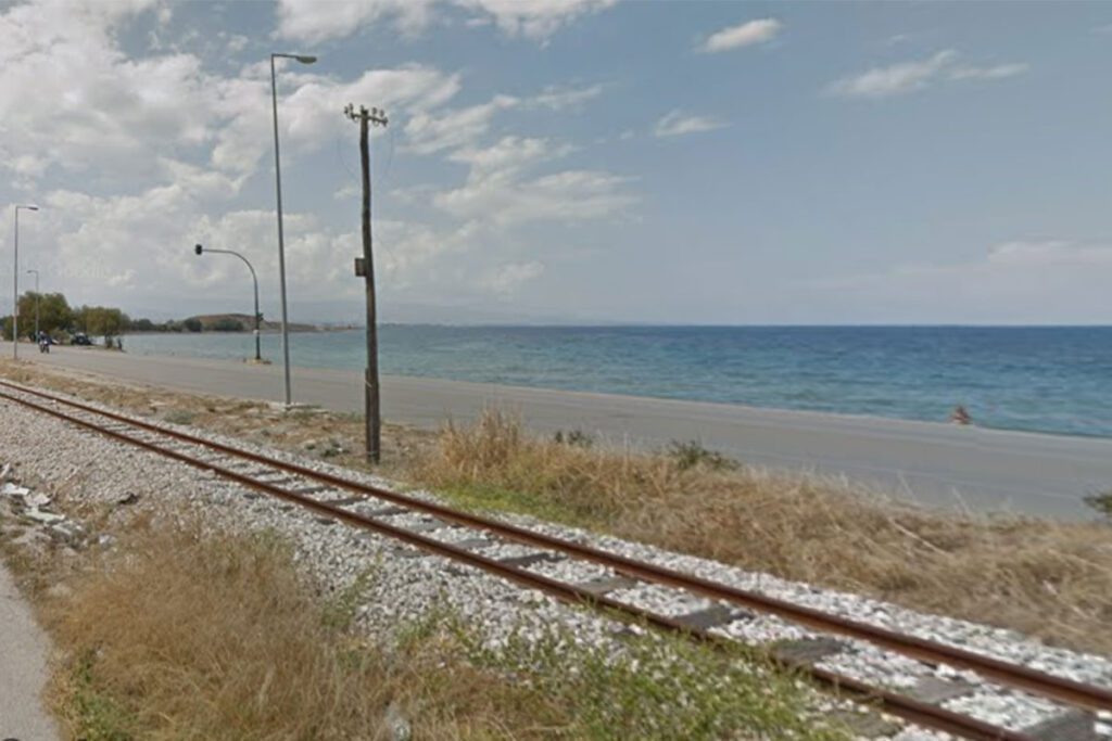
website: / website: / website: website: website: website: website: / / / / / Owner/holder of the abandoned railway: Owner/holder of the abandoned railway: Owner/holder of the abandoned railway: Owner/holder of the abandoned railway: Owner/holder of the abandoned railway: gpx file: gpx file: gpx file: gpx file: gpx file: This is a potential Greenway that goes through the north part of Peloponnese and in the last months the Regional offices and Gaia-Ose (the company responsible for the property of the railways) have signed an agreement which gives the authority to the region to act and transmit the railways into greenways within a big environmental park. The surface is smooth and it mainly goes in parallel to the seaside of corinth golf. This is a potential Greenway that goes through the north part of Peloponnese and in the last months the Regional offices and Gaia-Ose (the company responsible for the property of the railways) have signed an agreement which gives the authority to the region to act and transmit the railways into greenways within a big environmental park. The surface is smooth and it mainly goes in parallel to the seaside of corinth golf. This is a potential Greenway that goes through the north part of Peloponnese and in the last months the Regional offices and Gaia-Ose (the company responsible for the property of the railways) have signed an agreement which gives the authority to the region to act and transmit the railways into greenways within a big environmental park. The surface is smooth and it mainly goes in parallel to the seaside of corinth golf. This is a potential Greenway that goes through the north part of Peloponnese and in the last months the Regional offices and Gaia-Ose (the company responsible for the property of the railways) have signed an agreement which gives the authority to the region to act and transmit the railways into greenways within a big environmental park. The surface is smooth and it mainly goes in parallel to the seaside of corinth golf. Total distance: 53134 mTotal climbing: 279 mTotal descent: -273 m Total distance: 53134 m Total distance: 53134 m link Total climbing: 279 m Total climbing: 279 m Total descent: -273 m Total descent: -273 m The surrounding territory is mostly going near the seaside and inside the small villages and towns and the main plan is to re-create the area and transform it into an environmental park with areas for outdoor sports, facilities and open spaces. The area has an easy going surface and it’s good for biking and walking. Additionally, the greenway is very near the seaside and it offers easy access to the beach. The new peloponnese suburban train which runs a few kilometers away, starts from Athens and goes until Kiato where the train connects with the buses and serves the north part of Peloponnese. Peloponnese has several  buses that connect the major cities and villages in the area. Additionally, this greenway connects several small towns in the coast with various facilities. The surrounding territory is mostly going near the seaside and inside the small villages and towns and the main plan is to re-create the area and transform it into an environmental park with areas for outdoor sports, facilities and open spaces. The area has an easy going surface and it’s good for biking and walking. Additionally, the greenway is very near the seaside and it offers easy access to the beach. The new peloponnese suburban train which runs a few kilometers away, starts from Athens and goes until Kiato where the train connects with the buses and serves the north part of Peloponnese. Peloponnese has several  buses that connect the major cities and villages in the area. Additionally, this greenway connects several small towns in the coast with various facilities. The surrounding territory is mostly going near the seaside and inside the small villages and towns and the main plan is to re-create the area and transform it into an environmental park with areas for outdoor sports, facilities and open spaces. The area has an easy going surface and it’s good for biking and walking. Additionally, the greenway is very near the seaside and it offers easy access to the beach. The new peloponnese suburban train which runs a few kilometers away, starts from Athens and goes until Kiato where the train connects with the buses and serves the north part of Peloponnese. Peloponnese has several  buses that connect the major cities and villages in the area. Additionally, this greenway connects several small towns in the coast with various facilities. The surrounding territory is mostly going near the seaside and inside the small villages and towns and the main plan is to re-create the area and transform it into an environmental park with areas for outdoor sports, facilities and open spaces. The area has an easy going surface and it’s good for biking and walking. Additionally, the greenway is very near the seaside and it offers easy access to the beach. The new peloponnese suburban train which runs a few kilometers away, starts from Athens and goes until Kiato where the train connects with the buses and serves the north part of Peloponnese. Peloponnese has several  buses that connect the major cities and villages in the area. Additionally, this greenway connects several small towns in the coast with various facilities. The general surface of this area is smooth and easy for walking, biking and running. There are several places to visit in the area and it offers great potential for the summer months. Additionally, the regional offices are suggesting to build facilities for outdoor activities, open sports equipment, playgrounds and other units for exercising The general surface of this area is smooth and easy for walking, biking and running. There are several places to visit in the area and it offers great potential for the summer months. Additionally, the regional offices are suggesting to build facilities for outdoor activities, open sports equipment, playgrounds and other units for

Peloponnese : Corinth- Derveni Read More »

Nestos Rodopi trail

website: / website: / website: website: website: website: website: / / / / / Owner/holder of the abandoned railway: Owner/holder of the abandoned railway: Owner/holder of the abandoned railway: Owner/holder of the abandoned railway: Owner/holder of the abandoned railway: gpx file: gpx file: gpx file: gpx file: gpx file: This potential Greenway is in the old railways of North Greece that connected Stavroupoli and Kromiko. This part goes in parallel with the railways and Nestos River and passes through the abandoned village of Kromiko. Additionally, the railway passes from Stavroupoli bridge and several tunnels. In this path there are also abandoned stations such as Livera, Kromiko, and others that are important cultural heritage buildings. This potential Greenway is in the old railways of North Greece that connected Stavroupoli and Kromiko. This part goes in parallel with the railways and Nestos River and passes through the abandoned village of Kromiko. Additionally, the railway passes from Stavroupoli bridge and several tunnels. In this path there are also abandoned stations such as Livera, Kromiko, and others that are important cultural heritage buildings. This potential Greenway is in the old railways of North Greece that connected Stavroupoli and Kromiko. This part goes in parallel with the railways and Nestos River and passes through the abandoned village of Kromiko. Additionally, the railway passes from Stavroupoli bridge and several tunnels. In this path there are also abandoned stations such as Livera, Kromiko, and others that are important cultural heritage buildings. This potential Greenway is in the old railways of North Greece that connected Stavroupoli and Kromiko. This part goes in parallel with the railways and Nestos River and passes through the abandoned village of Kromiko. Additionally, the railway passes from Stavroupoli bridge and several tunnels. In this path there are also abandoned stations such as Livera, Kromiko, and others that are important cultural heritage buildings. Total distance: 6405 mTotal climbing: 288 mTotal descent: -335 m Total distance: 6405 m Total distance: 6405 m Total climbing: 288 m Total climbing: 288 m Total descent: -335 m Total descent: -335 m why not find out more Stavroupoli has a folklore museum, a Macedonian Tomb, and some cafes where visitors can enjoy their walks. Additionally, the area is important for its nature. There is a Wild Bird Observatory in Saint Tomas, Waterfalls while there are several viewpoints for observation and great views. As for sports, the river offers a lot of opportunities for watersports while there are facilities near Galini that visitors can rent equipment. There are several bus and train stations in the area since there are big cities nearby: Xanthi (around 14klm from Galini), Komotini (60klm) and Kavala (40 klm). On the other hand, at the moment the trains in the north part of the country are under suspension so visitors can travel only via bus. Stavroupoli has a folklore museum, a Macedonian Tomb, and some cafes where visitors can enjoy their walks. Additionally, the area is important for its nature. There is a Wild Bird Observatory in Saint Tomas, Waterfalls while there are several viewpoints for observation and great views. As for sports, the river offers a lot of opportunities for watersports while there are facilities near Galini that visitors can rent equipment. There are several bus and train stations in the area since there are big cities nearby: Xanthi (around 14klm from Galini), Komotini (60klm) and Kavala (40 klm). On the other hand, at the moment the trains in the north part of the country are under suspension so visitors can travel only via bus. Stavroupoli has a folklore museum, a Macedonian Tomb, and some cafes where visitors can enjoy their walks. Additionally, the area is important for its nature. There is a Wild Bird Observatory in Saint Tomas, Waterfalls while there are several viewpoints for observation and great views. As for sports, the river offers a lot of opportunities for watersports while there are facilities near Galini that visitors can rent equipment. There are several bus and train stations in the area since there are big cities nearby: Xanthi (around 14klm from Galini), Komotini (60klm) and Kavala (40 klm). On the other hand, at the moment the trains in the north part of the country are under suspension so visitors can travel only via bus. Stavroupoli has a folklore museum, a Macedonian Tomb, and some cafes where visitors can enjoy their walks. Additionally, the area is important for its nature. There is a Wild Bird Observatory in Saint Tomas, Waterfalls while there are several viewpoints for observation and great views. As for sports, the river offers a lot of opportunities for watersports while there are facilities near Galini that visitors can rent equipment. There are several bus and train stations in the area since there are big cities nearby: Xanthi (around 14klm from Galini), Komotini (60klm) and Kavala (40 klm). On the other hand, at the moment the trains in the north part of the country are under suspension so visitors can travel only via bus. The nearby area is known for its beauty and landscapes. There are several voices that underline the importance of the buildings and the heritage of the railways since it has a monumental value, expressing history and folk heritage. As explained before there are several areas to visit and enjoy nature such as the observatory of wild birds. Additionally, the area is offered for watersports in the river, for walking, hiking and trekking on several paths. The nearby area is known for its beauty and landscapes. There are several voices that underline the importance of the buildings and the heritage of the railways since it has a monumental value, expressing history and folk heritage. As explained before there are several areas to visit and enjoy nature such as the observatory of wild birds. Additionally, the area is offered for watersports in the river, for walking, hiking and trekking on several paths. The nearby area is known for its beauty and landscapes. There are several voices that underline the

Nestos Rodopi trail Read More »