Horse riding

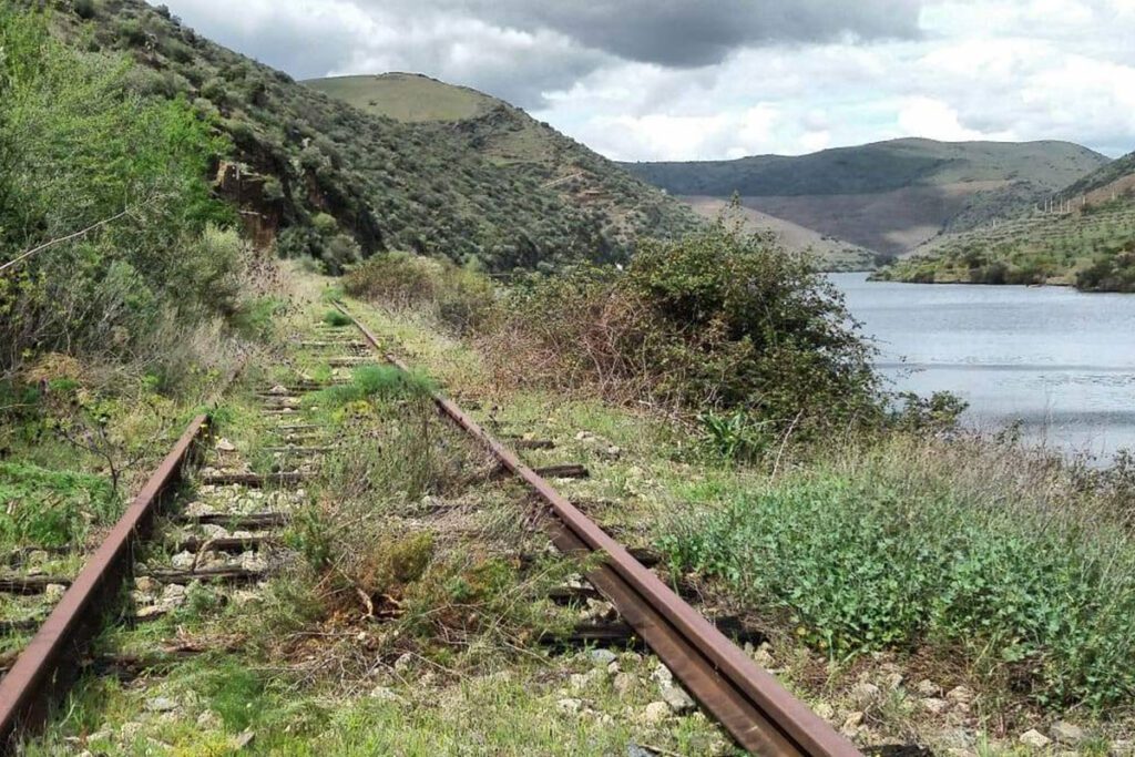
Douro Railway (from Pocinho till Barca de Alva)

offers on website: website: website: website: website: Owner/holder of the abandoned railway: IP Património/REFER Owner/holder of the abandoned railway: IP Património/REFER Owner/holder of the abandoned railway: Owner/holder of the abandoned railway: Owner/holder of the abandoned railway: Owner/holder of the abandoned railway: Owner/holder of the abandoned railway: IP Património/REFER IP Património/REFER IP Património/REFER IP Património/REFER IP Património/REFER gpx file: gpx file: gpx file: gpx file: gpx file: The railway has a 200 Km extension from Porto till Barca de Alva near the border with Spain. The potential greenway it’s the last kilometers between Pocinho and Braca de Alva in a extension of 29 Km. There are only two big stations in the last 29 km; all the other buildings are small train stops. The railway has a 200 Km extension from Porto till Barca de Alva near the border with Spain. The potential greenway it’s the last kilometers between Pocinho and Braca de Alva in a extension of 29 Km. There are only two big stations in the last 29 km; all the other buildings are small train stops. The railway has a 200 Km extension from Porto till Barca de Alva near the border with Spain. The potential greenway it’s the last kilometers between Pocinho and Braca de Alva in a extension of 29 Km. There are only two big stations in the last 29 km; all the other buildings are small train stops. The railway has a 200 Km extension from Porto till Barca de Alva near the border with Spain. The potential greenway it’s the last kilometers between Pocinho and Braca de Alva in a extension of 29 Km. There are only two big stations in the last 29 km; all the other buildings are small train stops. Total distance: 19386 mTotal climbing: 3 mTotal descent: 0 m Total distance: 19386 m Total distance: 19386 m Total climbing: 3 m Total climbing: 3 m Total descent: 0 m Total descent: 0 m The railway it’s always near the Douro River, the view is amazing. There is a historic train from Pocinho to Porto. On the Spanish side it has been created the Iron Road for tourist use https://www.caminodehierro.es. Credits: Espirito Viajante Considering the characteristics, user can currently hike. In the future, if the line were to become a greenway, it will depend on the type of surface that can be installed on the ground. Credits: The Brave Ones Potential users are pedestrians, bicycles, mountain bikes, runners and horse riders. There is no information on a plan for trasforming this railway into a greenway. At this moment the railway it’s abandoned. The railway it’s always near the Douro River, the view is amazing. There is a historic train from Pocinho to Porto. On the Spanish side it has been created the Iron Road for tourist use https://www.caminodehierro.es. Credits: Espirito Viajante Considering the characteristics, user can currently hike. In the future, if the line were to become a greenway, it will depend on the type of surface that can be installed on the ground. Credits: The Brave Ones Potential users are pedestrians, bicycles, mountain bikes, runners and horse riders. There is no information on a plan for trasforming this railway into a greenway. At this moment the railway it’s abandoned. The railway it’s always near the Douro River, the view is amazing. There is a historic train from Pocinho to Porto. On the Spanish side it has been created the Iron Road for tourist use https://www.caminodehierro.es. Credits: Espirito Viajante Considering the characteristics, user can currently hike. In the future, if the line were to become a greenway, it will depend on the type of surface that can be installed on the ground. Credits: The Brave Ones Potential users are pedestrians, bicycles, mountain bikes, runners and horse riders. There is no information on a plan for trasforming this railway into a greenway. At this moment the railway it’s abandoned. The railway it’s always near the Douro River, the view is amazing. There is a historic train from Pocinho to Porto. On the Spanish side it has been created the Iron Road for tourist use https://www.caminodehierro.es. Credits: Espirito Viajante Considering the characteristics, user can currently hike. In the future, if the line were to become a greenway, it will depend on the type of surface that can be installed on the ground. Credits: The Brave Ones Potential users are pedestrians, bicycles, mountain bikes, runners and horse riders. There is no information on a plan for trasforming this railway into a greenway. At this moment the railway it’s abandoned. The railway it’s always near the Douro River, the view is amazing. There is a historic train from Pocinho to Porto. On the Spanish side it has been created the Iron Road for tourist use https://www.caminodehierro.es. The railway it’s always near the Douro River, the view is amazing. There is a historic train from Pocinho to Porto. On the Spanish side it has been created the Iron Road for tourist use https://www.caminodehierro.es. The railway it’s always near the Douro River, the view is amazing. There is a historic train from Pocinho to Porto. On the Spanish side it has been created the Iron Road for tourist use https://www.caminodehierro.es. The railway it’s always near the Douro River, the view is amazing. There is a historic train from Pocinho to Porto. On the Spanish side it has been created the Iron Road for tourist use https://www.caminodehierro.es. Credits: Espirito Viajante Credits: Espirito Viajante Credits: Espirito Viajante Credits: Espirito Viajante Credits: Espirito Viajante Credits: Espirito Viajante Credits: Espirito Viajante Credits: Espirito Viajante Considering the characteristics, user can currently hike. In the future, if the line were to become a greenway, it will depend on the type of surface that can be installed on the ground. Considering the characteristics, user can currently hike. In the future, if the line were to become a greenway, it will depend on the type of surface that can be installed on the ground. Considering the characteristics, user can currently hike. In the

Douro Railway (from Pocinho till Barca de Alva) Read More »

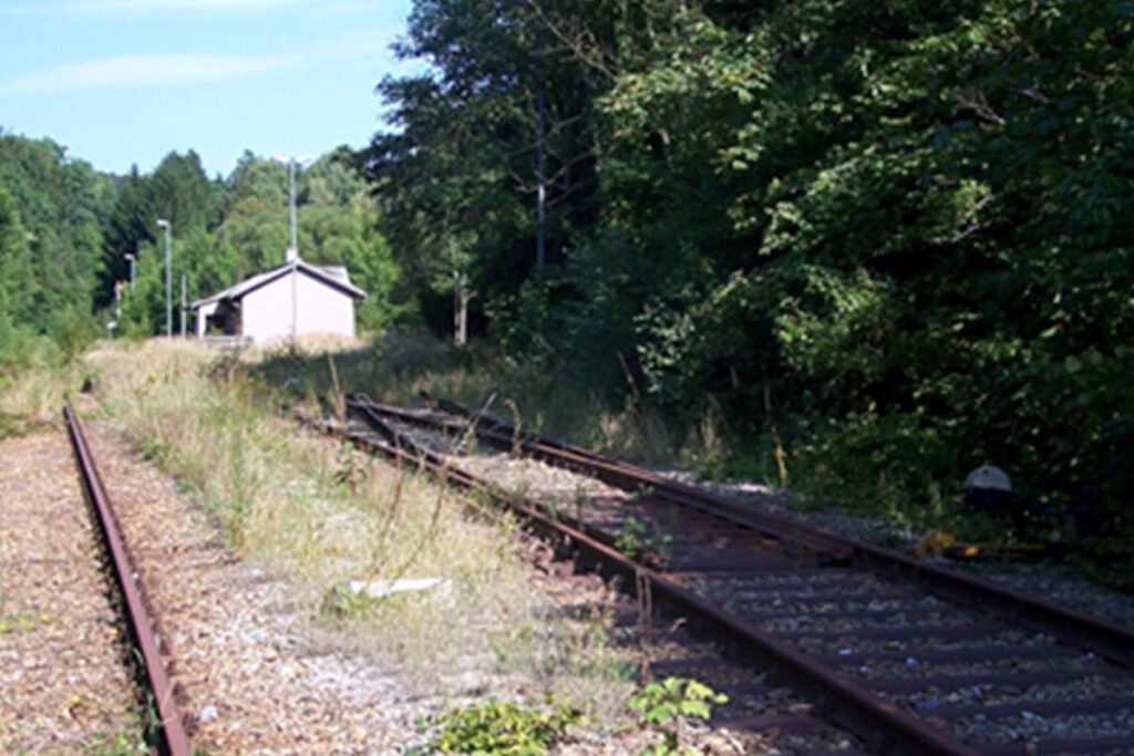
Hainfeld – Weißenbach an der Triesting, part of the LeobersdorferBahn that connected the Triestingtal and the Gölsental

website: website: website: website: website: Owner of the abandoned railway: The Lower Austrian Southwest Railways (NÖSWB) Owner of the abandoned railway: The Lower Austrian Southwest Railways (NÖSWB) Owner of the abandoned railway: Owner of the abandoned railway: Owner of the abandoned railway: Owner of the abandoned railway: Owner of the abandoned railway: The Lower Austrian Southwest Railways (NÖSWB) The Lower Austrian Southwest Railways (NÖSWB) The Lower Austrian Southwest Railways (NÖSWB) The Lower Austrian Southwest Railways (NÖSWB) The Lower Austrian Southwest Railways (NÖSWB) gpx file: gpx file: gpx file: gpx file: products gpx file: The railway line called “Weissenbach-Hainfeld” was opened in 1877 and was part of the Lower Austrian Southwest Railways (NÖSWB). It was almost 25 km long and was a single-track line with 3 intermediate stations, Altenmarkt-Thenneberg, Kaumberg, and court mountain and also had other stops, Kaumberg Markt, Altenmarkt an der Triesting, Tasshof, and Eberbach-Hocheck. The railway line was closed in 2004 and the tracks have been dismantled since 2015. One of the railway heritage of this railway is the concrete bridge over Hainfelder Straße (B18) over the Triesting at kilometer 28. Another important heritage of this railway is the Altenmarkt-Thenneberg station, located at kilometer 26.4 which had three through tracks and a short dead end track to the west, whose switch can be seen in front of the station building. Along the route, the bridge over the Triesting at kilometer 19.8 is also relatively new and it’s an important part of the railway heritage. Additionally, the Alter Gerichtsberg Tunnel and the Gerstbach Brücke are other significant heritage of this railway that are still preserved today. The railway line called “Weissenbach-Hainfeld” was opened in 1877 and was part of the Lower Austrian Southwest Railways (NÖSWB). It was almost 25 km long and was a single-track line with 3 intermediate stations, Altenmarkt-Thenneberg, Kaumberg, and court mountain and also had other stops, Kaumberg Markt, Altenmarkt an der Triesting, Tasshof, and Eberbach-Hocheck. The railway line was closed in 2004 and the tracks have been dismantled since 2015. One of the railway heritage of this railway is the concrete bridge over Hainfelder Straße (B18) over the Triesting at kilometer 28. Another important heritage of this railway is the Altenmarkt-Thenneberg station, located at kilometer 26.4 which had three through tracks and a short dead end track to the west, whose switch can be seen in front of the station building. Along the route, the bridge over the Triesting at kilometer 19.8 is also relatively new and it’s an important part of the railway heritage. Additionally, the Alter Gerichtsberg Tunnel and the Gerstbach Brücke are other significant heritage of this railway that are still preserved today. Total distance: 23818 mTotal climbing: 0 mTotal descent: 0 m Total distance: 23818 m Total distance: 23818 m Total climbing: 0 m Total climbing: 0 m Total descent: 0 m Total descent: 0 m Horse breeding farm along the route: Part of the Triesting Gölsental cycle route If the former railway line were to be converted into a greenway or cycle path, it could be used for a variety of sport and leisure activities. The relatively flat and smooth surface of the former railway line, along with its winding route through the mountainous region of the Triestingtal, would make it an ideal location for cycling. It could be used by both recreational and more serious cyclists for exercise, sightseeing, and commuting. The greenway or cycle path could also be used for hiking and walking. The winding route through the mountainous region of the Triestingtal would provide a scenic and relatively easy path for these activities. The route would provide a scenic and relatively easy walk through the mountainous region and could be enjoyed by people of all ages and abilities. Also, it could be a great opportunity for nature watching, birdwatching, wildlife observation, horseback riding, providing an opportunity for equestrian enthusiasts to explore the area on horseback. Additionally, it could also be used for rollerblading, skateboarding, scootering, and in line skating. If the former railway line were to be converted into a greenway or cycle path, it could be used for a variety of sport and leisure activities. The relatively flat and smooth surface of the former railway line, along with its winding route through the mountainous region of the Triestingtal, would make it an ideal location for cycling. It could be used by both recreational and more serious cyclists for exercise, sightseeing, and commuting. The greenway or cycle path could also be used for hiking and walking. The winding route through the mountainous region of the Triestingtal would provide a scenic and relatively easy path for these activities. The route would provide a scenic and relatively easy walk through the mountainous region and could be enjoyed by people of all ages and abilities. Also, it could be a great opportunity for nature watching, birdwatching, wildlife observation, horseback riding, providing an opportunity for equestrian enthusiasts to explore the area on horseback. Additionally, it could also be used for rollerblading, skateboarding, scootering, and in line skating. If the former railway line from Weissenbach to Hainfeld via the court mountain were to be converted into a greenway or cycle path, it could be used by a variety of potential users such as recreational and serious cyclists, hikers and walkers, nature enthusiasts, equestrian enthusiasts, families, tourists, rollerblading, skateboarding, Scootering enthusiasts for leisure, exercise, transportation, nature watching, birdwatching, wildlife observation, and as a destination for tourists. The success and popularity of the greenway or cycle path will depend on a variety of factors including location, accessibility, safety, and maintenance. (

Hainfeld – Weißenbach an der Triesting, part of the LeobersdorferBahn that connected the Triestingtal and the Gölsental Read More »

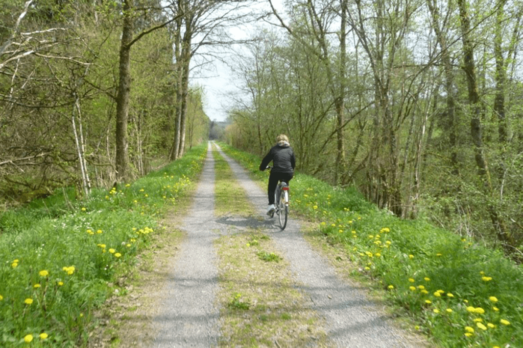
Pre-RAVeL of Line 618. From Assenois (Vaux-sur-Sûre) to Martelange

website: website: website: website: website: Owner/holder of the abandoned railway: The general legal framework in the Walloon Region is an emphyteutic lease between Wallonia and the SNCB, allowing the Walloon Region to use the former railways to develop greenways Owner/holder of the abandoned railway: The general legal framework in the Walloon Region is an emphyteutic lease between Wallonia and the SNCB, allowing the Walloon Region to use the former railways to develop greenways Owner/holder of the abandoned railway: Owner/holder of the abandoned railway: Owner/holder of the abandoned railway: more helpful hints Owner/holder of the abandoned railway: Owner/holder of the abandoned railway: The general legal framework in the Walloon Region is an emphyteutic lease between Wallonia and the SNCB, allowing the Walloon Region to use the former railways to develop greenways The general legal framework in the Walloon Region is an emphyteutic lease between Wallonia and the SNCB, allowing the Walloon Region to use the former railways to develop greenways The general legal framework in the Walloon Region is an emphyteutic lease between Wallonia and the SNCB, allowing the Walloon Region to use the former railways to develop greenways The general legal framework in the Walloon Region is an emphyteutic lease between Wallonia and the SNCB, allowing the Walloon Region to use the former railways to develop greenways The general legal framework in the Walloon Region is an emphyteutic lease between Wallonia and the SNCB, allowing the Walloon Region to use the former railways to develop greenways gpx file: gpx file: gpx file: gpx file: gpx file: This itinerary follows the old vicinal line 618, today developed into a pre-RAVeL between Assenois, the ponds of the Strange in Hompré and Martelange, in the province of Luxemburg in Begium, region of the Ardennes The “Pre-Ravel” goes through many villages in the Bastogne region, in the calm and idyllic setting of the Strange and Sûre valleys. It runs along the edge of the Strange ponds, between Hompré and Hollange, and will link its course to the meandering of the Sure river. Most of the route is in the Natura 2000 area, and the surrounding nature invites to enjoy outdoor and take a discovering and leisurely walk. Multiple educational totems along the way remind the origin of the line. On the territory of the municipality of Fauvillers, metal panels “Mémoire du Tram”, in the shape of the front of a locomotive, give the names of the old stops and local and historical information. This itinerary follows the old vicinal line 618, today developed into a pre-RAVeL between Assenois, the ponds of the Strange in Hompré and Martelange, in the province of Luxemburg in Begium, region of the Ardennes The “Pre-Ravel” goes through many villages in the Bastogne region, in the calm and idyllic setting of the Strange and Sûre valleys. It runs along the edge of the Strange ponds, between Hompré and Hollange, and will link its course to the meandering of the Sure river. Most of the route is in the Natura 2000 area, and the surrounding nature invites to enjoy outdoor and take a discovering and leisurely walk. Multiple educational totems along the way remind the origin of the line. On the territory of the municipality of Fauvillers, metal panels “Mémoire du Tram”, in the shape of the front of a locomotive, give the names of the old stops and local and historical information. Total distance: 21316 mTotal climbing: 556 mTotal descent: -436 m Total distance: 21316 m Total distance: 21316 m Total climbing: 556 m Total climbing: 556 m Total descent: -436 m Total descent: -436 m Very good connexions with sports equipment’s, namely the sports hall in Martelange is right nearby. Great diversity of natural and cultural assets, the greenway crosses a very beautiful & historically valuable rural area, the Ardennes region. It is right on the border of Luxembourg, which gives it a cross-border interest. Parc de la Haute-Sure/Foret d’Anlier: the area around the Maison du Parc invites to discover local ecosystems: signposted walks, recreational facilities, including the “bird walk” & the “biodiversity labyrinth Ardoise Museum Haut-Martelange: provides a complete overview of a mining industry that has shaped the region for 200 years. Bastogne War Museum. The main World War II memorial site in Belgium, with a focus on the Battle of the Ardennes. Considering the characteristics, the main activities are: c Potential users are cyclists, walkers, horse riders and; no information about people with reduced mobility. The route is already developed as Pre-Ravel. Improvement works are planned: development of the RAVeL between Radelange and Martelange (1 km). Stage: award of works. Potential users are cyclists, walkers, horse riders and; no information about people with reduced mobility. The route is already developed as Pre-Ravel. Improvement works are planned: development of the RAVeL between Radelange and Martelange (1 km). Stage: award of works. Potential users are cyclists, walkers, horse riders and; no information about people with reduced mobility. Potential users are c The route is already developed as Pre-Ravel. Improvement works are planned: development of the RAVeL between Radelange and Martelange (1 km). Stage: award of works.

Pre-RAVeL of Line 618. From Assenois (Vaux-sur-Sûre) to Martelange Read More »

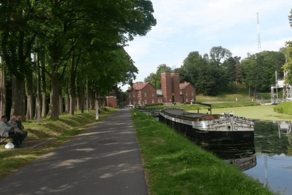
Lines 107 & 114 La Louvière station –Central Channel

website: / website: / website: website: website: website: offers on website: / / / / / Owner/holder of the abandoned railway: The general legal framework in the Walloon Region is an emphyteutic lease between Wallonia and the SNCB, allowing the Walloon Region to use the former railways to develop greenways Owner/holder of the abandoned railway: The general legal framework in the Walloon Region is an emphyteutic lease between Wallonia and the SNCB, allowing the Walloon Region to use the former railways to develop greenways Owner/holder of the abandoned railway: Owner/holder of the abandoned railway: Owner/holder of the abandoned railway: Owner/holder of the abandoned railway: Owner/holder of the abandoned railway: The general legal framework in the Walloon Region is an emphyteutic lease between Wallonia and the SNCB, allowing the Walloon Region to use the former railways to develop greenways The general legal framework in the Walloon Region is an emphyteutic lease between Wallonia and the SNCB, allowing the Walloon Region to use the former railways to develop greenways The general legal framework in the Walloon Region is an emphyteutic lease between Wallonia and the SNCB, allowing the Walloon Region to use the former railways to develop greenways The general legal framework in the Walloon Region is an emphyteutic lease between Wallonia and the SNCB, allowing the Walloon Region to use the former railways to develop greenways The general legal framework in the Walloon Region is an emphyteutic lease between Wallonia and the SNCB, allowing the Walloon Region to use the former railways to develop greenways gpx file: gpx file: gpx file: gpx file: gpx file: Total distance: 0 mTotal climbing: 0 mTotal descent: 0 m Total distance: 0 m Total distance: 0 m Total climbing: 0 m Total climbing: 0 m Total descent: 0 m Total descent: 0 m This greenway will allow to stablish a connexion with shops and sports centres. This will be a regional interchange node (train and bus station); a link with the schools will also be established. The Four Lifts on the Canal du Centre and their Environs, La Louvière and Le Roeulx (Hainaut) are a UNESCO World Heritage Site. The four hydraulic boat-lifts together with the canal itself and its associated structures, constitute a remarkably well-preserved and complete example of a late-19th-century industrial landscape. Located over a distance of 7 km, each one covering a change in level of 15 to 16 meters. They are the only ones in the world which still exist in their original working condition. Credits: EGWA Credits: EGWA Credits: EGWA Credits: EGWA Credits: EGWA Credits: EGWA Credits: EGWA Credits: EGWA Considering the characteristics, the main activities are: cycling, walking, jogging, horse riding, Considering the characteristics, the main activities are: cycling, walking, jogging, horse riding, Considering the characteristics, the main activities are: cycling, walking, jogging, horse riding, Considering the characteristics, the main activities are: c ycling, walking, jogging, horse riding, Credits: Walloon Region Credits: Walloon Region Credits: Walloon Region Credits: Walloon Region The potential users are cyclists, walkers, horse riders and, most likely, people with reduced mobility (to be confirmed upon completion of the pre-study), as usual  in the RAVel  -greenways.  There is a plan by Walloon Region for transforming this abandoned railway into a greenway. Stage: pre-study. The potential users are cyclists, walkers, horse riders and, most likely, people with reduced mobility (to be confirmed upon completion of the pre-study), as usual  in the RAVel  -greenways.  There is a plan by Walloon Region for transforming this abandoned railway into a greenway. Stage: pre-study. The potential users are cyclists, walkers, horse riders and, most likely, people with reduced mobility (to be confirmed upon completion of the pre-study), as usual  in the RAVel  -greenways.  The potential users are There is a plan by Walloon Region for transforming this abandoned railway into a greenway. Stage: pre-study. There is a plan by Walloon Region for transforming this abandoned railway into a greenway. Stage: pre-study.

Lines 107 & 114 La Louvière station –Central Channel Read More »

Line 115/2 Tubize-Braine l’Alleud

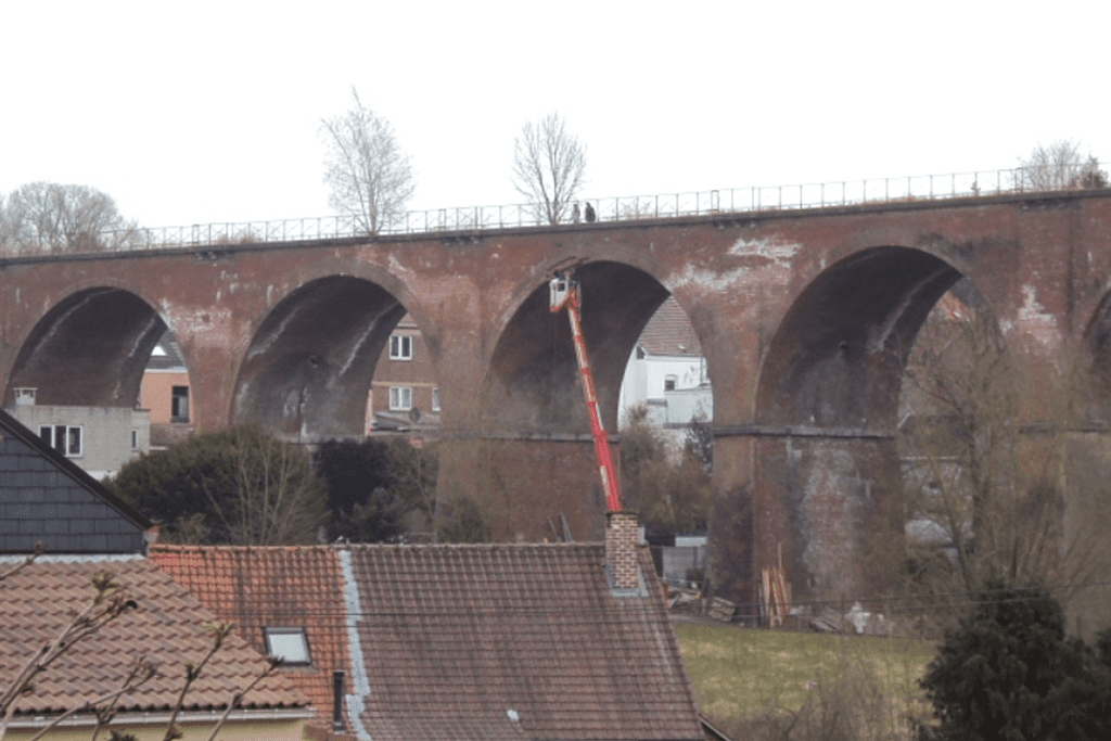
website: website: website: website: website: Owner/holder of the abandoned railway: Emphyteutic lease between Wallonia and the SNCB, allowing Walloon region to use the former railway line 115 Braine l’Alleud – Clabecq for the transformation of this line into a greenway. Owner/holder of the abandoned railway: Emphyteutic lease between Wallonia and the SNCB, allowing Walloon region to use the former railway line 115 Braine l’Alleud – Clabecq for the transformation of this line into a greenway. Owner/holder of the abandoned railway: Owner/holder of the abandoned railway: Owner/holder of the abandoned railway: Owner/holder of the abandoned railway: Owner/holder of the abandoned railway: Emphyteutic lease between Wallonia and the SNCB, allowing Walloon region to use the former railway line 115 Braine l’Alleud – Clabecq for the transformation of this line into a greenway. Emphyteutic lease between Wallonia and the SNCB, allowing Walloon region to use the former railway line 115 Braine l’Alleud – Clabecq for the transformation of this line into a greenway. Emphyteutic lease between Wallonia and the SNCB, allowing Walloon region to use the former railway line 115 Braine l’Alleud – Clabecq for the transformation of this line into a greenway. Emphyteutic lease between Wallonia and the SNCB, allowing Walloon region to use the former railway line 115 Braine l’Alleud – Clabecq for the transformation of this line into a greenway. Emphyteutic lease between Wallonia and the SNCB, allowing Walloon region to use the former railway line 115 Braine l’Alleud – Clabecq for the transformation of this line into a greenway. gpx file: gpx file: gpx file: gpx file: gpx file: Conversion of the former railway line 115 from Braine-l’Alleud to Clabecq via Braine-le-Château into a greenway (RAVeL as is named in Walloon region). Will connect with the RAVel on the Charleroi-Brussels canal, part of the regional cycle route network W3. Located in a Urban and suburban area. Work will include rehabilitation of the engineering structures (45) including the Estrée viaduct (brick bridge with 16 arches) and construction of the RAVeL- greenway (11.2km): asphalting over a width of 3m and a lateral bridleway. Intervention by the Walloon Region, the municipalities concerned and the Province of Walloon Brabant. This greenway is very important for soft modes of mobility as it links Braine l’Alleud station to the Hain area and further on to Clabecq and Tubize, avoiding the Tubize road which is very busy with traffic. Work on the RAVeL is in progress. Note: The map show an aapproximate itinerary, which will be detailed after the completion of the greenway. Conversion of the former railway line 115 from Braine-l’Alleud to Clabecq via Braine-le-Château into a greenway (RAVeL as is named in Walloon region). Will connect with the RAVel on the Charleroi-Brussels canal, part of the regional cycle route network W3. Located in a Urban and suburban area. Work will include rehabilitation of the engineering structures (45) including the Estrée viaduct (brick bridge with 16 arches) and construction of the RAVeL- greenway (11.2km): asphalting over a width of 3m and a lateral bridleway. Intervention by the Walloon Region, the municipalities concerned and the Province of Walloon Brabant. This greenway is very important for soft modes of mobility as it links Braine l’Alleud station to the Hain area and further on to Clabecq and Tubize, avoiding the Tubize road which is very busy with traffic. Work on the RAVeL is in progress. Note: The map show an aapproximate itinerary, which will be detailed after the completion of the greenway. Total distance: 0 mTotal climbing: 0 mTotal descent: 0 m Total distance: 0 m Total distance: 0 m Total climbing: 0 mTotal descent: 0 m Total climbing: 0 m basics Total climbing: 0 m Total descent: 0 m Total descent: 0 m Total descent: 0 m The potential of this future RAVeL is significant and very diversified; it will be the backbone of many safe rides & walks for children, families, less experienced cyclists, etc. Sports centres, schools, municipal administration premises, shops, etc. are close to this structuring greenway. Will avoid the crossroads of Mont-Saint-Pont, too dangerous in its current configuration. Will permit reaching companies located in the industrial zone by bike, Connection with the important communication node that is the SNCB and TEC Braine-l’Alleud station, which serves around ten destinations. Braine-l’Alleud) Credits: RAVel Wallon Region Credits: RAVel Wallon Region Credits: RAVel Wallon Region Credits: RAVel Wallon Region Credits: RAVel Wallon Region Credits: RAVel Wallon Region Credits: RAVel Wallon Region Credits: RAVel Wallon Region This greenway has been strongly demanded locally for sustainable mobility. The highest expected use  will be cycling for active mobility; it will be, as generally in greenways, suitable for cycling, walking, running, horse riding. This greenway has been strongly demanded locally for sustainable mobility. The highest expected use  will be cycling for active mobility; it will be, as generally in greenways, suitable for cycling, walking, running, horse riding. This greenway has been strongly demanded locally for sustainable mobility. The highest expected use  will be cycling for active mobility; it will be, as generally in greenways, suitable for cycling, walking, running, horse riding. Credits: EGWA; Base for the greenway drawing, RAVEL portal Credits: EGWA; Base for the greenway drawing, RAVEL portal Credits: EGWA; Base for the greenway drawing, RAVEL portal Credits: EGWA; Base for the greenway drawing, RAVEL portal Cyclists, walkers, horse riders and, most likely, people with reduced mobility (to be confirmed upon completion of the work), as usual  in the RAVel  -greenways. There is a plan for trasforming the abandoned railway into a greenway. Works are currently underway. The work is funded by the Walloon Region and the Province of Walloon Brabant is the contracting authority for this project. Cyclists, walkers, horse riders and, most likely, people with reduced mobility (to be confirmed upon completion of the work), as usual  in the RAVel  -greenways. There is a plan for trasforming the abandoned railway into a greenway. Works are currently underway. The work is funded by the Walloon Region and the Province of Walloon Brabant is the contracting authority for this

Line 115/2 Tubize-Braine l’Alleud Read More »

Alberche Greenway

website: website: website: website: website: Owner/holder of the abandoned railway: NOT KNOWN Owner/holder of the abandoned railway: NOT KNOWN Owner/holder of the abandoned railway: Owner/holder of the abandoned railway: Owner/holder of the abandoned railway: Owner/holder of the abandoned railway: Owner/holder of the abandoned railway: NOT KNOWN NOT KNOWN NOT KNOWN NOT KNOWN NOT KNOWN additional resources gpx file: gpx file: gpx file: gpx file: gpx file: It is one of the best routes for ease in the Madrid Region and for going permanently next to the water. It is a beautiful route, with water present all the way and with many bridges to cross. There are bridges and tunnels. It is one of the best routes for ease in the Madrid Region and for going permanently next to the water. It is a beautiful route, with water present all the way and with many bridges to cross. There are bridges and tunnels. It is one of the best routes for ease in the Madrid Region and for going permanently next to the water. It is a beautiful route, with water present all the way and with many bridges to cross. There are bridges and tunnels. Total distance: 14038 mTotal climbing: 377 mTotal descent: -378 m Total distance: 14038 m Total distance: 14038 m Total climbing: 377 m Total climbing: 377 m Total descent: -378 m Total descent: -378 m Point of interest: Picada Water Reservoir Intermodality: Car park available at the start of the path Point of interest: Picada Water Reservoir Intermodality: Car park available at the start of the path Point of interest: Picada Water Reservoir Point of interest: Intermodality: Car park available at the start of the path Intermodality Considering the characteristics, the main activities are: walking, running, cycling, horse riding, suitable for kids. Considering the characteristics, the main activities are: walking, running, cycling, horse riding, suitable for kids. Considering the characteristics, the main activities are: walking, running, cycling, horse riding, suitable for kids. Considering the characteristics, the main activities are: w alking, running, cycling, horse riding, suitable for kids. Potential users could be pedestrians, hikers, runners, horse riders. There are no plans for transforming this abandoned railway into a greenway. Potential users could be pedestrians, hikers, runners, horse riders. There are no plans for transforming this abandoned railway into a greenway. Potential users could be pedestrians, hikers, runners, horse riders. Potential users could be pedestrians, hikers, runners, horse riders. There are no plans for transforming this abandoned railway into a greenway. There are no plans for transforming this abandoned railway into a greenway.

Alberche Greenway Read More »

Continuation of the Guadarrama Greenway

click to read website: website: website: website: website: Owner/holder of the abandoned railway: ADIF (Administrador de Infraestructuras Ferroviarias) Owner/holder of the abandoned railway: ADIF (Administrador de Infraestructuras Ferroviarias) Owner/holder of the abandoned railway: Owner/holder of the abandoned railway: Owner/holder of the abandoned railway: Owner/holder of the abandoned railway: Owner/holder of the abandoned railway: ADIF (Administrador de Infraestructuras Ferroviarias) ADIF (Administrador de Infraestructuras Ferroviarias) ADIF (Administrador de Infraestructuras Ferroviarias) ADIF (Administrador de Infraestructuras Ferroviarias) ADIF (Administrador de Infraestructuras Ferroviarias) gpx file: gpx file: gpx file: gpx file: gpx file: The route follows an old railway at the gates of the big city of Madrid that extends along a pleasant landscape of cultivated fields. The itinerary goes through the villages of Navalcarnero and Villamanta. The route follows an old railway at the gates of the big city of Madrid that extends along a pleasant landscape of cultivated fields. The itinerary goes through the villages of Navalcarnero and Villamanta. The route follows an old railway at the gates of the big city of Madrid that extends along a pleasant landscape of cultivated fields. The itinerary goes through the villages of Navalcarnero and Villamanta. Total distance: 48585 mTotal climbing: 614 mTotal descent: -586 m Total distance: 48585 m Total distance: 48585 m Total climbing: 614 m Total climbing: 614 m Total descent: -586 m Total descent: -586 m Intermodality: Regional trains from Móstoles to Madrid, interurban buses. Connection with Greenway: Connected to the already existing Greenway of the Guadarrama. Considering the characteristics, the main activities are: hiking, mountain climbing, cycling, horse riding, natural and educational excursions.  Intermodality: Regional trains from Móstoles to Madrid, interurban buses. Connection with Greenway: Connected to the already existing Greenway of the Guadarrama. Considering the characteristics, the main activities are: hiking, mountain climbing, cycling, horse riding, natural and educational excursions.  Intermodality: Regional trains from Móstoles to Madrid, interurban buses. Intermodality: Connection with Greenway: Connected to the already existing Greenway of the Guadarrama. Connection with Greenway: Considering the characteristics, the main activities are: hiking, mountain climbing, cycling, horse riding, natural and educational excursions.  Considering the characteristics, the main activities are: hiking, mountain climbing, cycling, horse riding, natural and educational excursions.  The potential users are pedestrians, cyclists, mountain bike, horse riders, climbers.  There are no plans for transforming this abandoned railway into a greenway. The potential users are pedestrians, cyclists, mountain bike, horse riders, climbers.  There are no plans for transforming this abandoned railway into a greenway. The potential users are pedestrians, cyclists, mountain bike, horse riders, climbers.  The potential users are pedestrians, cyclists, mountain bike, horse riders, climbers.  There are no plans for transforming this abandoned railway into a greenway. There are no plans for transforming this abandoned railway into a greenway.

Continuation of the Guadarrama Greenway Read More »