MTB

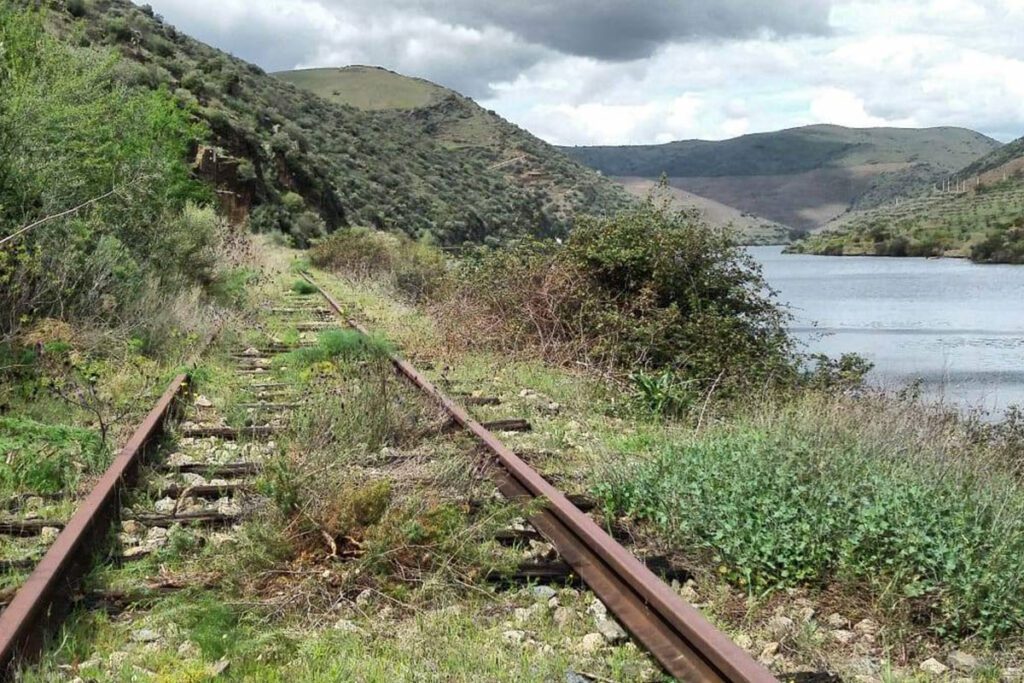
Douro Railway (from Pocinho till Barca de Alva)

offers on website: website: website: website: website: Owner/holder of the abandoned railway: IP Património/REFER Owner/holder of the abandoned railway: IP Património/REFER Owner/holder of the abandoned railway: Owner/holder of the abandoned railway: Owner/holder of the abandoned railway: Owner/holder of the abandoned railway: Owner/holder of the abandoned railway: IP Património/REFER IP Património/REFER IP Património/REFER IP Património/REFER IP Património/REFER gpx file: gpx file: gpx file: gpx file: gpx file: The railway has a 200 Km extension from Porto till Barca de Alva near the border with Spain. The potential greenway it’s the last kilometers between Pocinho and Braca de Alva in a extension of 29 Km. There are only two big stations in the last 29 km; all the other buildings are small train stops. The railway has a 200 Km extension from Porto till Barca de Alva near the border with Spain. The potential greenway it’s the last kilometers between Pocinho and Braca de Alva in a extension of 29 Km. There are only two big stations in the last 29 km; all the other buildings are small train stops. The railway has a 200 Km extension from Porto till Barca de Alva near the border with Spain. The potential greenway it’s the last kilometers between Pocinho and Braca de Alva in a extension of 29 Km. There are only two big stations in the last 29 km; all the other buildings are small train stops. The railway has a 200 Km extension from Porto till Barca de Alva near the border with Spain. The potential greenway it’s the last kilometers between Pocinho and Braca de Alva in a extension of 29 Km. There are only two big stations in the last 29 km; all the other buildings are small train stops. Total distance: 19386 mTotal climbing: 3 mTotal descent: 0 m Total distance: 19386 m Total distance: 19386 m Total climbing: 3 m Total climbing: 3 m Total descent: 0 m Total descent: 0 m The railway it’s always near the Douro River, the view is amazing. There is a historic train from Pocinho to Porto. On the Spanish side it has been created the Iron Road for tourist use https://www.caminodehierro.es. Credits: Espirito Viajante Considering the characteristics, user can currently hike. In the future, if the line were to become a greenway, it will depend on the type of surface that can be installed on the ground. Credits: The Brave Ones Potential users are pedestrians, bicycles, mountain bikes, runners and horse riders. There is no information on a plan for trasforming this railway into a greenway. At this moment the railway it’s abandoned. The railway it’s always near the Douro River, the view is amazing. There is a historic train from Pocinho to Porto. On the Spanish side it has been created the Iron Road for tourist use https://www.caminodehierro.es. Credits: Espirito Viajante Considering the characteristics, user can currently hike. In the future, if the line were to become a greenway, it will depend on the type of surface that can be installed on the ground. Credits: The Brave Ones Potential users are pedestrians, bicycles, mountain bikes, runners and horse riders. There is no information on a plan for trasforming this railway into a greenway. At this moment the railway it’s abandoned. The railway it’s always near the Douro River, the view is amazing. There is a historic train from Pocinho to Porto. On the Spanish side it has been created the Iron Road for tourist use https://www.caminodehierro.es. Credits: Espirito Viajante Considering the characteristics, user can currently hike. In the future, if the line were to become a greenway, it will depend on the type of surface that can be installed on the ground. Credits: The Brave Ones Potential users are pedestrians, bicycles, mountain bikes, runners and horse riders. There is no information on a plan for trasforming this railway into a greenway. At this moment the railway it’s abandoned. The railway it’s always near the Douro River, the view is amazing. There is a historic train from Pocinho to Porto. On the Spanish side it has been created the Iron Road for tourist use https://www.caminodehierro.es. Credits: Espirito Viajante Considering the characteristics, user can currently hike. In the future, if the line were to become a greenway, it will depend on the type of surface that can be installed on the ground. Credits: The Brave Ones Potential users are pedestrians, bicycles, mountain bikes, runners and horse riders. There is no information on a plan for trasforming this railway into a greenway. At this moment the railway it’s abandoned. The railway it’s always near the Douro River, the view is amazing. There is a historic train from Pocinho to Porto. On the Spanish side it has been created the Iron Road for tourist use https://www.caminodehierro.es. The railway it’s always near the Douro River, the view is amazing. There is a historic train from Pocinho to Porto. On the Spanish side it has been created the Iron Road for tourist use https://www.caminodehierro.es. The railway it’s always near the Douro River, the view is amazing. There is a historic train from Pocinho to Porto. On the Spanish side it has been created the Iron Road for tourist use https://www.caminodehierro.es. The railway it’s always near the Douro River, the view is amazing. There is a historic train from Pocinho to Porto. On the Spanish side it has been created the Iron Road for tourist use https://www.caminodehierro.es. Credits: Espirito Viajante Credits: Espirito Viajante Credits: Espirito Viajante Credits: Espirito Viajante Credits: Espirito Viajante Credits: Espirito Viajante Credits: Espirito Viajante Credits: Espirito Viajante Considering the characteristics, user can currently hike. In the future, if the line were to become a greenway, it will depend on the type of surface that can be installed on the ground. Considering the characteristics, user can currently hike. In the future, if the line were to become a greenway, it will depend on the type of surface that can be installed on the ground. Considering the characteristics, user can currently hike. In the

Douro Railway (from Pocinho till Barca de Alva) Read More »

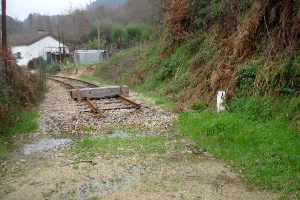
Tâmega Railway (between Livração and Amarante)

website: website: website: website: website: Owner/holder of the abandoned railway: IP Património/REFER Owner/holder of the abandoned railway: IP Património/REFER look at this now Owner/holder of the abandoned railway: Owner/holder of the abandoned railway: Owner/holder of the abandoned railway: Owner/holder of the abandoned railway: Owner/holder of the abandoned railway: IP Património/REFER IP Património/REFER IP Património/REFER IP Património/REFER IP Património/REFER gpx file: gpx file: gpx file: gpx file: gpx file: It’s a 12,77 Km railway in the valley of the Tâmega River, it was inaugurated in 1909 and crosses 6 villages till it finishes in the city of Amarante. This short railway has 3 bridges. It’s a 12,77 Km railway in the valley of the Tâmega River, it was inaugurated in 1909 and crosses 6 villages till it finishes in the city of Amarante. This short railway has 3 bridges. It’s a 12,77 Km railway in the valley of the Tâmega River, it was inaugurated in 1909 and crosses 6 villages till it finishes in the city of Amarante. This short railway has 3 bridges. It’s a 12,77 Km railway in the valley of the Tâmega River, it was inaugurated in 1909 and crosses 6 villages till it finishes in the city of Amarante. This short railway has 3 bridges. Total distance: 8646 mTotal climbing: 0 mTotal descent: -32 m Total distance: 8646 m Total distance: 8646 m Total climbing: 0 m Total climbing: 0 m Total descent: -32 m Total descent: -32 m All the villages have small buildings or small train stops, but the main station building it’s in the city of Amarante. From Amarante to Arco de Baúlhe – Cabeceiras de Basto, the greenway is already transformed (39 km).   https://www.ippatrimonio.pt/pt-pt/ecopistas-ip-patrimonio/ecopista-do-tamega Potential activities depend on the type of surface they can install on the ground. Potential users are pedestrians, runners and mountain bikers. If there is a plan for transforming this railway into a greenway, it’s not public yet. All the villages have small buildings or small train stops, but the main station building it’s in the city of Amarante. From Amarante to Arco de Baúlhe – Cabeceiras de Basto, the greenway is already transformed (39 km).   https://www.ippatrimonio.pt/pt-pt/ecopistas-ip-patrimonio/ecopista-do-tamega Potential activities depend on the type of surface they can install on the ground. Potential users are pedestrians, runners and mountain bikers. If there is a plan for transforming this railway into a greenway, it’s not public yet. All the villages have small buildings or small train stops, but the main station building it’s in the city of Amarante. From Amarante to Arco de Baúlhe – Cabeceiras de Basto, the greenway is already transformed (39 km).   https://www.ippatrimonio.pt/pt-pt/ecopistas-ip-patrimonio/ecopista-do-tamega Potential activities depend on the type of surface they can install on the ground. Potential users are pedestrians, runners and mountain bikers. If there is a plan for transforming this railway into a greenway, it’s not public yet. All the villages have small buildings or small train stops, but the main station building it’s in the city of Amarante. From Amarante to Arco de Baúlhe – Cabeceiras de Basto, the greenway is already transformed (39 km).   https://www.ippatrimonio.pt/pt-pt/ecopistas-ip-patrimonio/ecopista-do-tamega Potential activities depend on the type of surface they can install on the ground. Potential users are pedestrians, runners and mountain bikers. If there is a plan for transforming this railway into a greenway, it’s not public yet. All the villages have small buildings or small train stops, but the main station building it’s in the city of Amarante. From Amarante to Arco de Baúlhe – Cabeceiras de Basto, the greenway is already transformed (39 km).   https://www.ippatrimonio.pt/pt-pt/ecopistas-ip-patrimonio/ecopista-do-tamega All the villages have small buildings or small train stops, but the main station building it’s in the city of Amarante. From Amarante to Arco de Baúlhe – Cabeceiras de Basto, the greenway is already transformed (39 km).   https://www.ippatrimonio.pt/pt-pt/ecopistas-ip-patrimonio/ecopista-do-tamega All the villages have small buildings or small train stops, but the main station building it’s in the city of Amarante. All the villages have small buildings or small train stops, but the main station building it’s in the city of Amarante. From Amarante to Arco de Baúlhe – Cabeceiras de Basto, the greenway is already transformed (39 km).   https://www.ippatrimonio.pt/pt-pt/ecopistas-ip-patrimonio/ecopista-do-tamega From Amarante to Arco de Baúlhe – Cabeceiras de Basto, the greenway is already transformed (39 km).   https://www.ippatrimonio.pt/pt-pt/ecopistas-ip-patrimonio/ecopista-do-tamega Potential activities depend on the type of surface they can install on the ground. Potential activities depend on the type of surface they can install on the ground. Potential activities depend on the type of surface they can install on the ground. Potential activities depend on the type of surface they can install on the ground. Potential users are pedestrians, runners and mountain bikers. If there is a plan for transforming this railway into a greenway, it’s not public yet. Potential users are pedestrians, runners and mountain bikers. If there is a plan for transforming this railway into a greenway, it’s not public yet. Potential users are pedestrians, runners and mountain bikers. Potential users are pedestrians, runners and mountain bikers. If there is a plan for transforming this railway into a greenway, it’s not public yet. If there is a plan for transforming this railway into a greenway, it’s not public yet.

Tâmega Railway (between Livração and Amarante) Read More »

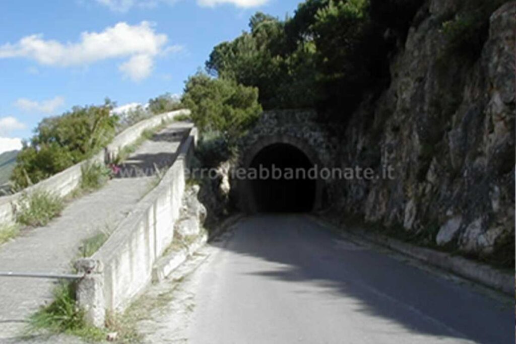
Palermo Lolli-Monreale-Camporeale ex-railway

website: / website: / website: website: website: website: website: / / / / / Owner of the abandoned railway: Italian Railways of the State (Ferrovie dello Stato) Owner of the abandoned railway: Italian Railways of the State (Ferrovie dello Stato) Owner of the abandoned railway: Owner of the abandoned railway: Owner of the abandoned railway: Owner of the abandoned railway: Owner of the abandoned railway: Italian Railways of the State (Ferrovie dello Stato) Italian Railways of the State (Ferrovie dello Stato) Italian Railways of the State (Ferrovie dello Stato) Italian Railways of the State (Ferrovie dello Stato) Italian Railways of the State (Ferrovie dello Stato) see page gpx file: gpx file: gpx file: gpx file: gpx file: The construction of the railway Palermo Lolli-Monreale-Camporeale began in 1924 and continued until 1935, when the railway infrastructure dedicated to the construction was sent to Africa. The railway,was entirely built from Palermo to Camporeale (about 65 km long). The Palermo – Monreale section was also equipped as a railway, but it never started working. Today there is still a debate about if an initial part was actually equipped with tracks or not. Currently it’s not always possible to identify the old railway. On one hand, some sections of the ex-railway has been transformed (between Monreale and Pianetto and between Piana degli Albanesi and S. Cipirello)into ordinary roads, where it’s still possible to see tunnels and old reinforced walls. On the other hand, the ex railway, is often recognizable as a field road or path with bridges and viaducts, although there are frequent interruptions due to the surrounding fields. The stations are now used as private houses. Along the 85 km track, characterised by 900 m of height difference, presence of 16 tunnels (considering also the two destroyed during the war) and 6 viaducts. The construction of the railway Palermo Lolli-Monreale-Camporeale began in 1924 and continued until 1935, when the railway infrastructure dedicated to the construction was sent to Africa. The railway,was entirely built from Palermo to Camporeale (about 65 km long). The Palermo – Monreale section was also equipped as a railway, but it never started working. Today there is still a debate about if an initial part was actually equipped with tracks or not. Currently it’s not always possible to identify the old railway. On one hand, some sections of the ex-railway has been transformed (between Monreale and Pianetto and between Piana degli Albanesi and S. Cipirello)into ordinary roads, where it’s still possible to see tunnels and old reinforced walls. On the other hand, the ex railway, is often recognizable as a field road or path with bridges and viaducts, although there are frequent interruptions due to the surrounding fields. The stations are now used as private houses. Along the 85 km track, characterised by 900 m of height difference, presence of 16 tunnels (considering also the two destroyed during the war) and 6 viaducts. The construction of the railway Palermo Lolli-Monreale-Camporeale began in 1924 and continued until 1935, when the railway infrastructure dedicated to the construction was sent to Africa. The railway,was entirely built from Palermo to Camporeale (about 65 km long). The Palermo – Monreale section was also equipped as a railway, but it never started working. Today there is still a debate about if an initial part was actually equipped with tracks or not. Currently it’s not always possible to identify the old railway. On one hand, some sections of the ex-railway has been transformed (between Monreale and Pianetto and between Piana degli Albanesi and S. Cipirello)into ordinary roads, where it’s still possible to see tunnels and old reinforced walls. On the other hand, the ex railway, is often recognizable as a field road or path with bridges and viaducts, although there are frequent interruptions due to the surrounding fields. The stations are now used as private houses. Along the 85 km track, characterised by 900 m of height difference, presence of 16 tunnels (considering also the two destroyed during the war) and 6 viaducts. Total distance: 0 mTotal climbing: 0 mTotal descent: 0 m Total distance: 0 m Total distance: 0 m Total climbing: 0 m Total climbing: 0 m Total descent: 0 m Total descent: 0 m Palermo offers a wide range of sport activities: skydiving and freediving and thanks to the proximity to the mountains it is possible to ride mountain bikes and to trek. A great point of interest is Monte Pellegrino with a great view over the city. The track of the old railway passes through the green area of the park Uditore and the old station that today is a private house. Near the park there is a sport area with tennis courts. There are also several manufactures of historical interest, such as stations (Uditore, Baida, Monreale, Altofonte) several cantoniere houses, many bridges (among which the most famous is the one near Boccadifalco that has become the symbol) and several tunnels. In some cases some of the structures have recently been restored ( Monreale station become the headquarters of the health care authority). Monreale is a picturesque town just outside Palermo, famous for its architectural heritage and the fine mosaics in its Norman cathedral. Monreale and Palermo are connected by regular city buses. One of the most famous and symbolic event of the city is the Feast of the Holy Cross that took place in May. Palermo offers a wide range of sport activities: skydiving and freediving and thanks to the proximity to the mountains it is possible to ride mountain bikes and to trek. A great point of interest is Monte Pellegrino with a great view over the city. The track of the old railway passes through the green area of the park Uditore and the old station that today is a private house. Near the park there is a sport area with tennis courts. There are also several manufactures of historical interest, such as stations (Uditore, Baida, Monreale, Altofonte) several cantoniere houses, many bridges (among which the most famous is

Palermo Lolli-Monreale-Camporeale ex-railway Read More »

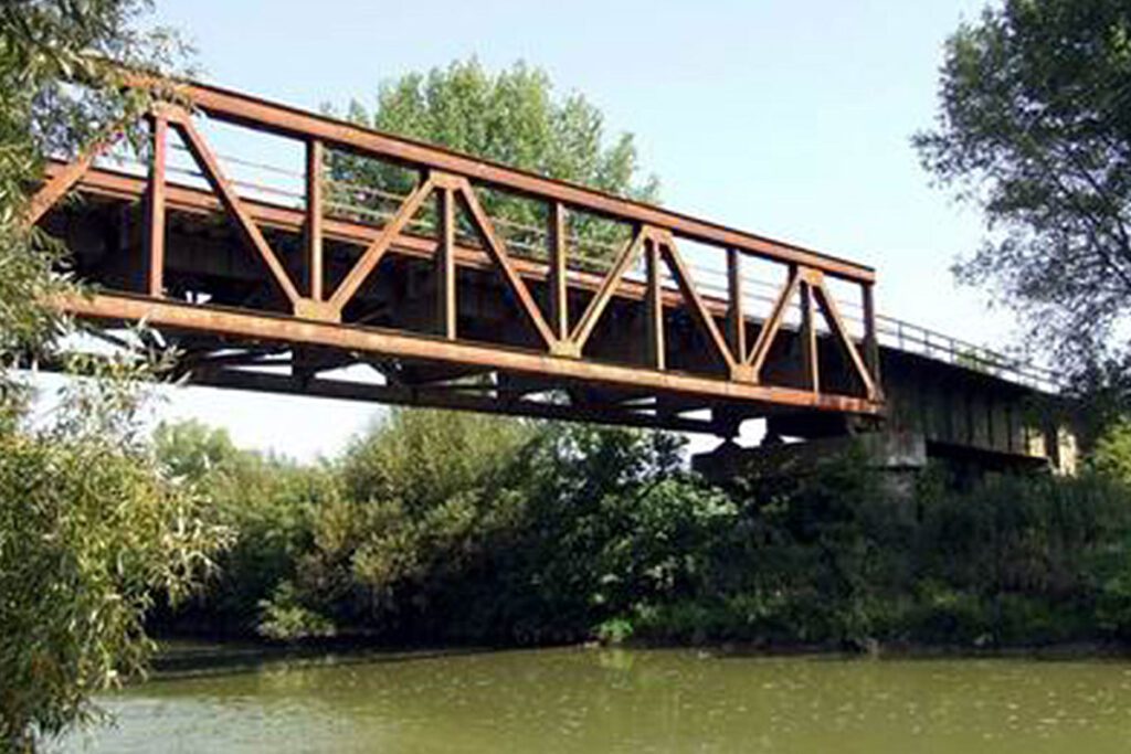
Zlaté Moravce – Lužianky railway

website: website: website: website: website: Owner of the abandoned railway: Slovak Republic Railways (Železnice Slovenskej republiky) Owner of the abandoned railway: Slovak Republic Railways (Železnice Slovenskej republiky) Owner of the abandoned railway: Owner of the abandoned railway: Owner of the abandoned railway: Owner of the abandoned railway: Owner of the abandoned railway: Slovak Republic Railways (Železnice Slovenskej republiky) Slovak Republic Railways (Železnice Slovenskej republiky) Slovak Republic Railways (Železnice Slovenskej republiky) Slovak Republic Railways (Železnice Slovenskej republiky) Slovak Republic Railways (Železnice Slovenskej republiky) gpx file: gpx file: gpx file: gpx file: gpx file: There are 6 stations between Lužianky and Zlaté Moravce (Drážovce, Podhorany, Žirany, Jelenec, Ladice, Sľažany). It simultaneously crosses the flat area of south Slovakia and also the hilly area of central Slovakia (Tribeč mountains). There are several bridges over the railway, viaducts on the rail too. There is a bridge over the river Nitra. There are 6 stations between Lužianky and Zlaté Moravce (Drážovce, Podhorany, Žirany, Jelenec, Ladice, Sľažany). It simultaneously crosses the flat area of south Slovakia and also the hilly area of central Slovakia (Tribeč mountains). There are several bridges over the railway, viaducts on the rail too. There is a bridge over the river Nitra. There are 6 stations between Lužianky and Zlaté Moravce (Drážovce, Podhorany, Žirany, Jelenec, Ladice, Sľažany). It simultaneously crosses the flat area of south Slovakia and also the hilly area of central Slovakia (Tribeč mountains). There are several bridges over the railway, viaducts on the rail too. There is a bridge over the river Nitra. There are 6 stations between Lužianky and Zlaté Moravce (Drážovce, Podhorany, Žirany, Jelenec, Ladice, Sľažany). It simultaneously crosses the flat area of south Slovakia and also the hilly area of central Slovakia (Tribeč mountains). There are several bridges over the railway, viaducts on the rail too. There is a bridge over the river Nitra. Total distance: 32231 mTotal climbing: 175 mTotal descent: -145 m Total distance: 32231 m Total distance: 32231 m Total climbing: 175 m Total climbing: 175 m Total descent: -145 m Total descent: -145 m Tribeč area offers many interesting hiking paths close to the city Nitra and can be accessible from the railway.  Tribeč is also very popular with mountain bikers since there are a lot of paths interweaving the hills. Intermodality: Lužianky station can be reached from Nitra by train and the train station is directly next to the bus station in Nitra. In Zlaté Moravce, stations are within 1,2 km from each other. Credits: https://kzmbojnice.railnet.sk/zastavka-nedozery-na-moduloch/ Considering the characteristics, the main activities are: cycling, walking, running, trekking, nordic walking, hiking, skating, mountain biking. Credits: https://kzmbojnice.railnet.sk/zastavka-nedozery-na-moduloch/ Since the railway is located in a flat area of the country mostly in a close proximity to the river Váh, it could be potentially visited by all people, even with reduced mobility. There is no steep incline and it should be accessible by anyone. There is no plan in action at the moment. Passenger transport was cancelled, it may still be used for cargo transport. Tribeč area offers many interesting hiking paths close to the city Nitra and can be accessible from the railway.  Tribeč is also very popular with mountain bikers since there are a lot of paths interweaving the hills. Intermodality: Lužianky station can be reached from Nitra by train and the train station is directly next to the bus station in Nitra. In Zlaté Moravce, stations are within 1,2 km from each other. Credits: https://kzmbojnice.railnet.sk/zastavka-nedozery-na-moduloch/ Considering the characteristics, the main activities are: cycling, walking, running, trekking, nordic walking, hiking, skating, mountain biking. Credits: https://kzmbojnice.railnet.sk/zastavka-nedozery-na-moduloch/ Since the railway is located in a flat area of the country mostly in a close proximity to the river Váh, it could be potentially visited by all people, even with reduced mobility. There is no steep incline and it should be accessible by anyone. There is no plan in action at the moment. Passenger transport was cancelled, it may still be used for cargo transport. Tribeč area offers many interesting hiking paths close to the city Nitra and can be accessible from the railway.  Tribeč is also very popular with mountain bikers since there are a lot of paths interweaving the hills. Intermodality: Lužianky station can be reached from Nitra by train and the train station is directly next to the bus station in Nitra. In Zlaté Moravce, stations are within 1,2 km from each other. Credits: https://kzmbojnice.railnet.sk/zastavka-nedozery-na-moduloch/ Considering the characteristics, the main activities are: cycling, walking, running, trekking, nordic walking, hiking, skating, mountain biking. Credits: https://kzmbojnice.railnet.sk/zastavka-nedozery-na-moduloch/ Since the railway is located in a flat area of the country mostly in a close proximity to the river Váh, it could be potentially visited by all people, even with reduced mobility. There is no steep incline and it should be accessible by anyone. There is no plan in action at the moment. Passenger transport was cancelled, it may still be used for cargo transport. Tribeč area offers many interesting hiking paths close to the city Nitra and can be accessible from the railway.  Tribeč is also very popular with mountain bikers since there are a lot of paths interweaving the hills. Intermodality: Lužianky station can be reached from Nitra by train and the train station is directly next to the bus station in Nitra. In Zlaté Moravce, stations are within 1,2 km from each other. Credits: https://kzmbojnice.railnet.sk/zastavka-nedozery-na-moduloch/ Considering the characteristics, the main activities are: cycling, walking, running, trekking, nordic walking, hiking, skating, mountain biking. Credits: https://kzmbojnice.railnet.sk/zastavka-nedozery-na-moduloch/ Since the railway is located in a flat area of the country mostly in a close proximity to the river Váh, it could be potentially visited by all people, even with reduced mobility. There is no steep incline and it should be accessible by anyone. There is no plan in action at the moment. Passenger transport was cancelled, it may still be used for cargo transport. Tribeč area offers many interesting hiking paths close to the city Nitra and can be accessible from the railway.  Tribeč is also very popular with

Zlaté Moravce – Lužianky railway Read More »

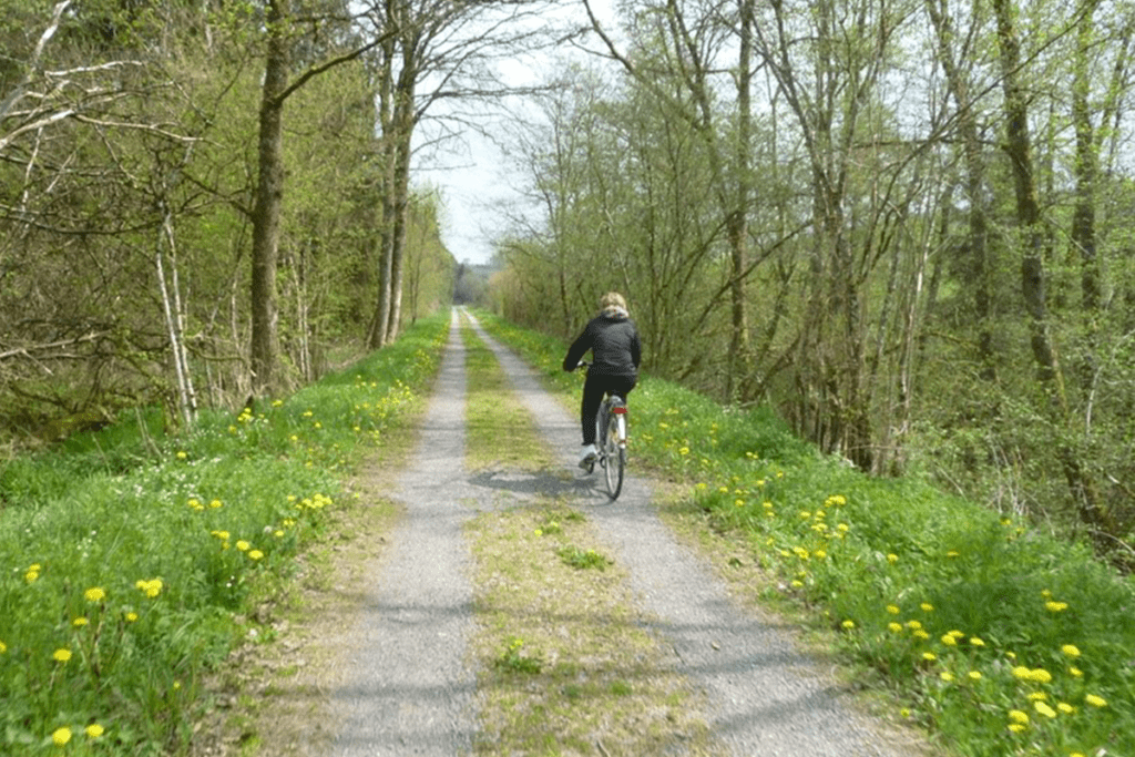
Pre-RAVeL of Line 618. From Assenois (Vaux-sur-Sûre) to Martelange

website: website: website: website: website: Owner/holder of the abandoned railway: The general legal framework in the Walloon Region is an emphyteutic lease between Wallonia and the SNCB, allowing the Walloon Region to use the former railways to develop greenways Owner/holder of the abandoned railway: The general legal framework in the Walloon Region is an emphyteutic lease between Wallonia and the SNCB, allowing the Walloon Region to use the former railways to develop greenways Owner/holder of the abandoned railway: Owner/holder of the abandoned railway: Owner/holder of the abandoned railway: more helpful hints Owner/holder of the abandoned railway: Owner/holder of the abandoned railway: The general legal framework in the Walloon Region is an emphyteutic lease between Wallonia and the SNCB, allowing the Walloon Region to use the former railways to develop greenways The general legal framework in the Walloon Region is an emphyteutic lease between Wallonia and the SNCB, allowing the Walloon Region to use the former railways to develop greenways The general legal framework in the Walloon Region is an emphyteutic lease between Wallonia and the SNCB, allowing the Walloon Region to use the former railways to develop greenways The general legal framework in the Walloon Region is an emphyteutic lease between Wallonia and the SNCB, allowing the Walloon Region to use the former railways to develop greenways The general legal framework in the Walloon Region is an emphyteutic lease between Wallonia and the SNCB, allowing the Walloon Region to use the former railways to develop greenways gpx file: gpx file: gpx file: gpx file: gpx file: This itinerary follows the old vicinal line 618, today developed into a pre-RAVeL between Assenois, the ponds of the Strange in Hompré and Martelange, in the province of Luxemburg in Begium, region of the Ardennes The “Pre-Ravel” goes through many villages in the Bastogne region, in the calm and idyllic setting of the Strange and Sûre valleys. It runs along the edge of the Strange ponds, between Hompré and Hollange, and will link its course to the meandering of the Sure river. Most of the route is in the Natura 2000 area, and the surrounding nature invites to enjoy outdoor and take a discovering and leisurely walk. Multiple educational totems along the way remind the origin of the line. On the territory of the municipality of Fauvillers, metal panels “Mémoire du Tram”, in the shape of the front of a locomotive, give the names of the old stops and local and historical information. This itinerary follows the old vicinal line 618, today developed into a pre-RAVeL between Assenois, the ponds of the Strange in Hompré and Martelange, in the province of Luxemburg in Begium, region of the Ardennes The “Pre-Ravel” goes through many villages in the Bastogne region, in the calm and idyllic setting of the Strange and Sûre valleys. It runs along the edge of the Strange ponds, between Hompré and Hollange, and will link its course to the meandering of the Sure river. Most of the route is in the Natura 2000 area, and the surrounding nature invites to enjoy outdoor and take a discovering and leisurely walk. Multiple educational totems along the way remind the origin of the line. On the territory of the municipality of Fauvillers, metal panels “Mémoire du Tram”, in the shape of the front of a locomotive, give the names of the old stops and local and historical information. Total distance: 21316 mTotal climbing: 556 mTotal descent: -436 m Total distance: 21316 m Total distance: 21316 m Total climbing: 556 m Total climbing: 556 m Total descent: -436 m Total descent: -436 m Very good connexions with sports equipment’s, namely the sports hall in Martelange is right nearby. Great diversity of natural and cultural assets, the greenway crosses a very beautiful & historically valuable rural area, the Ardennes region. It is right on the border of Luxembourg, which gives it a cross-border interest. Parc de la Haute-Sure/Foret d’Anlier: the area around the Maison du Parc invites to discover local ecosystems: signposted walks, recreational facilities, including the “bird walk” & the “biodiversity labyrinth Ardoise Museum Haut-Martelange: provides a complete overview of a mining industry that has shaped the region for 200 years. Bastogne War Museum. The main World War II memorial site in Belgium, with a focus on the Battle of the Ardennes. Considering the characteristics, the main activities are: c Potential users are cyclists, walkers, horse riders and; no information about people with reduced mobility. The route is already developed as Pre-Ravel. Improvement works are planned: development of the RAVeL between Radelange and Martelange (1 km). Stage: award of works. Potential users are cyclists, walkers, horse riders and; no information about people with reduced mobility. The route is already developed as Pre-Ravel. Improvement works are planned: development of the RAVeL between Radelange and Martelange (1 km). Stage: award of works. Potential users are cyclists, walkers, horse riders and; no information about people with reduced mobility. Potential users are c The route is already developed as Pre-Ravel. Improvement works are planned: development of the RAVeL between Radelange and Martelange (1 km). Stage: award of works.

Pre-RAVeL of Line 618. From Assenois (Vaux-sur-Sûre) to Martelange Read More »