The Dobermannsdorf – Loidesthal
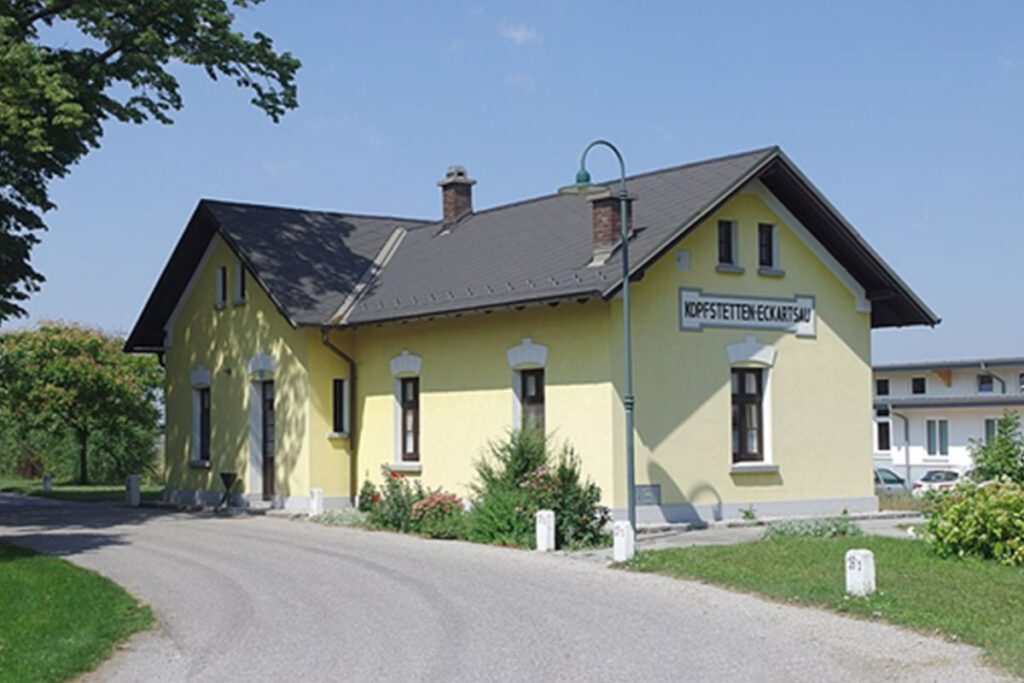
website: website: website: website: website: Owner of the abandoned railway: State of Lower Austria Owner of the abandoned railway: State of Lower Austria Owner of the abandoned railway: Owner of the abandoned railway: Owner of the abandoned railway: Owner of the abandoned railway: Owner of the abandoned railway: State of Lower Austria State of Lower Austria State of Lower Austria State of Lower Austria State of Lower Austria gpx file: gpx file: gpx file: gpx file: gpx file: The potential greenway with a total distance of around 15 kilometers along the former railway line. The villages of Palterndorf, Dobermannsdorf, Gösting, Zistersdorf, Eichhorn, Loidesthal, Blumenthal, Windisch-Baumgarten, Großinzersdorf and Gaiselberg will be integrated into the cycle path network. The potential greenway with a total distance of around 15 kilometers along the former railway line. The villages of Palterndorf, Dobermannsdorf, Gösting, Zistersdorf, Eichhorn, Loidesthal, Blumenthal, Windisch-Baumgarten, Großinzersdorf and Gaiselberg will be integrated into the cycle path network. The potential greenway with a total distance of around 15 kilometers along the former railway line. The villages of Palterndorf, Dobermannsdorf, Gösting, Zistersdorf, Eichhorn, Loidesthal, Blumenthal, Windisch-Baumgarten, Großinzersdorf and Gaiselberg will be integrated into the cycle path network. site Total distance: 6436 mTotal climbing: 0 mTotal descent: 0 m Total distance: 6436 m Total distance: 6436 m Total climbing: 0 m Total climbing: 0 m Total descent: 0 m Total descent: 0 m The connections to the international Eurovelo9 and the Kamp-Thaya-March-Radweg (KTM): There is a direct connection between the new cycling facility and the regional “Muskateller” and “Traminer” cycle routes, as well as the connection to the international cycle route Eurovelo 9 from Vienna to Breclav and to the Lower Austrian main cycle route Kamp-Thaya-March-Radweg. These connections indicate that the new greenway, cycle path or special heritage will be linked to existing cycling routes and this will provide more options for recreational cycling and tourism. Retrieved from Google Maps. Unused railway station on Dobermannsdorf Retrieved from Google Maps. Unused railway station on Dobermannsdorf Retrieved from Google Maps. Unused railway station on Dobermannsdorf Retrieved from Google Maps. Unused railway station on Dobermannsdorf Retrieved from Google Maps. Unused railway station on Dobermannsdorf Retrieved from Google Maps. Unused railway station on Dobermannsdorf Retrieved from Google Maps. Unused railway station on Dobermannsdorf Retrieved from Google Maps. Unused railway station on Dobermannsdorf The railway between Dobermannsdorf and Loidesthal is planned to be repurposed as a greenway, offering a variety of sport and leisure activities such as cycling, walking, hiking, rollerblading, skateboarding, wildlife and nature observation and picnics. The greenway will also connect different villages and communities, providing a safe and scenic route for visitors and locals. It will also be connected to existing cycling routes, offering more options for recreational cycling and tourism. There are also tourist attraction centers on the former railway line such as Wehrturm, Memorial Park Kriegerdenkmal bei Wallfahrtskirche Maria Moos, Weinpresse Hauerbaum. (The touristic areas on the route were researched on Google earth.) The railway between Dobermannsdorf and Loidesthal is planned to be repurposed as a greenway, offering a variety of sport and leisure activities such as cycling, walking, hiking, rollerblading, skateboarding, wildlife and nature observation and picnics. The greenway will also connect different villages and communities, providing a safe and scenic route for visitors and locals. It will also be connected to existing cycling routes, offering more options for recreational cycling and tourism. There are also tourist attraction centers on the former railway line such as Wehrturm, Memorial Park Kriegerdenkmal bei Wallfahrtskirche Maria Moos, Weinpresse Hauerbaum. (The touristic areas on the route were researched on Google earth.) The railway between Dobermannsdorf and Loidesthal is planned to be repurposed as a greenway, offering a variety of sport and leisure activities such as cycling, walking, hiking, rollerblading, skateboarding, wildlife and nature observation and picnics. The greenway will also connect different villages and communities, providing a safe and scenic route for visitors and locals. It will also be connected to existing cycling routes, offering more options for recreational cycling and tourism. There are also tourist attraction centers on the former railway line such as Wehrturm, Memorial Park Kriegerdenkmal bei Wallfahrtskirche Maria Moos, Weinpresse Hauerbaum. (The touristic areas on the route were researched on Google earth.) (The touristic areas on the route were researched on Google earth.) Potential users of the railway greenway include local residents, cyclists, walkers/hikers, rollerbladers/ skateboarders, families, nature enthusiasts, and tourists. The greenway offers safe, convenient, and scenic options for transportation, recreation, and nature observation. The municipality of Zistersdorf, the market town of Palterndorf – Dobermannsdorf and the state of Lower Austria have decided to expand the no longer used railway line between the two municipalities for cyclists and thus connect the municipalities. Potential users of the railway greenway include local residents, cyclists, walkers/hikers, rollerbladers/ skateboarders, families, nature enthusiasts, and tourists. The greenway offers safe, convenient, and scenic options for transportation, recreation, and nature observation. The municipality of Zistersdorf, the market town of Palterndorf – Dobermannsdorf and the state of Lower Austria have decided to expand the no longer used railway line between the two municipalities for cyclists and thus connect the municipalities. Potential users of the railway greenway include local residents, cyclists, walkers/hikers, rollerbladers/ skateboarders, families, nature enthusiasts, and tourists. The greenway offers safe, convenient, and scenic options for transportation, recreation, and nature observation. The municipality of Zistersdorf, the market town of Palterndorf – Dobermannsdorf and the state of Lower Austria have decided to expand the no longer used railway line between the two municipalities for cyclists and thus connect the municipalities.
The Dobermannsdorf – Loidesthal Read More »


