Jogging

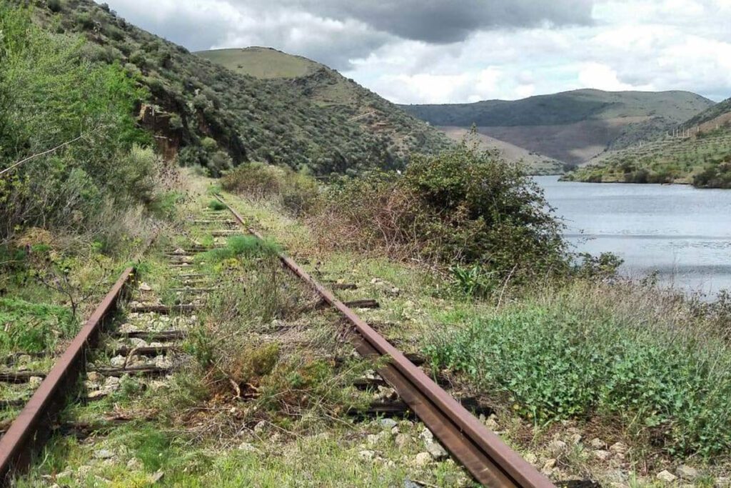
Douro Railway (from Pocinho till Barca de Alva)

offers on website: website: website: website: website: Owner/holder of the abandoned railway: IP Património/REFER Owner/holder of the abandoned railway: IP Património/REFER Owner/holder of the abandoned railway: Owner/holder of the abandoned railway: Owner/holder of the abandoned railway: Owner/holder of the abandoned railway: Owner/holder of the abandoned railway: IP Património/REFER IP Património/REFER IP Património/REFER IP Património/REFER IP Património/REFER gpx file: gpx file: gpx file: gpx file: gpx file: The railway has a 200 Km extension from Porto till Barca de Alva near the border with Spain. The potential greenway it’s the last kilometers between Pocinho and Braca de Alva in a extension of 29 Km. There are only two big stations in the last 29 km; all the other buildings are small train stops. The railway has a 200 Km extension from Porto till Barca de Alva near the border with Spain. The potential greenway it’s the last kilometers between Pocinho and Braca de Alva in a extension of 29 Km. There are only two big stations in the last 29 km; all the other buildings are small train stops. The railway has a 200 Km extension from Porto till Barca de Alva near the border with Spain. The potential greenway it’s the last kilometers between Pocinho and Braca de Alva in a extension of 29 Km. There are only two big stations in the last 29 km; all the other buildings are small train stops. The railway has a 200 Km extension from Porto till Barca de Alva near the border with Spain. The potential greenway it’s the last kilometers between Pocinho and Braca de Alva in a extension of 29 Km. There are only two big stations in the last 29 km; all the other buildings are small train stops. Total distance: 19386 mTotal climbing: 3 mTotal descent: 0 m Total distance: 19386 m Total distance: 19386 m Total climbing: 3 m Total climbing: 3 m Total descent: 0 m Total descent: 0 m The railway it’s always near the Douro River, the view is amazing. There is a historic train from Pocinho to Porto. On the Spanish side it has been created the Iron Road for tourist use https://www.caminodehierro.es. Credits: Espirito Viajante Considering the characteristics, user can currently hike. In the future, if the line were to become a greenway, it will depend on the type of surface that can be installed on the ground. Credits: The Brave Ones Potential users are pedestrians, bicycles, mountain bikes, runners and horse riders. There is no information on a plan for trasforming this railway into a greenway. At this moment the railway it’s abandoned. The railway it’s always near the Douro River, the view is amazing. There is a historic train from Pocinho to Porto. On the Spanish side it has been created the Iron Road for tourist use https://www.caminodehierro.es. Credits: Espirito Viajante Considering the characteristics, user can currently hike. In the future, if the line were to become a greenway, it will depend on the type of surface that can be installed on the ground. Credits: The Brave Ones Potential users are pedestrians, bicycles, mountain bikes, runners and horse riders. There is no information on a plan for trasforming this railway into a greenway. At this moment the railway it’s abandoned. The railway it’s always near the Douro River, the view is amazing. There is a historic train from Pocinho to Porto. On the Spanish side it has been created the Iron Road for tourist use https://www.caminodehierro.es. Credits: Espirito Viajante Considering the characteristics, user can currently hike. In the future, if the line were to become a greenway, it will depend on the type of surface that can be installed on the ground. Credits: The Brave Ones Potential users are pedestrians, bicycles, mountain bikes, runners and horse riders. There is no information on a plan for trasforming this railway into a greenway. At this moment the railway it’s abandoned. The railway it’s always near the Douro River, the view is amazing. There is a historic train from Pocinho to Porto. On the Spanish side it has been created the Iron Road for tourist use https://www.caminodehierro.es. Credits: Espirito Viajante Considering the characteristics, user can currently hike. In the future, if the line were to become a greenway, it will depend on the type of surface that can be installed on the ground. Credits: The Brave Ones Potential users are pedestrians, bicycles, mountain bikes, runners and horse riders. There is no information on a plan for trasforming this railway into a greenway. At this moment the railway it’s abandoned. The railway it’s always near the Douro River, the view is amazing. There is a historic train from Pocinho to Porto. On the Spanish side it has been created the Iron Road for tourist use https://www.caminodehierro.es. The railway it’s always near the Douro River, the view is amazing. There is a historic train from Pocinho to Porto. On the Spanish side it has been created the Iron Road for tourist use https://www.caminodehierro.es. The railway it’s always near the Douro River, the view is amazing. There is a historic train from Pocinho to Porto. On the Spanish side it has been created the Iron Road for tourist use https://www.caminodehierro.es. The railway it’s always near the Douro River, the view is amazing. There is a historic train from Pocinho to Porto. On the Spanish side it has been created the Iron Road for tourist use https://www.caminodehierro.es. Credits: Espirito Viajante Credits: Espirito Viajante Credits: Espirito Viajante Credits: Espirito Viajante Credits: Espirito Viajante Credits: Espirito Viajante Credits: Espirito Viajante Credits: Espirito Viajante Considering the characteristics, user can currently hike. In the future, if the line were to become a greenway, it will depend on the type of surface that can be installed on the ground. Considering the characteristics, user can currently hike. In the future, if the line were to become a greenway, it will depend on the type of surface that can be installed on the ground. Considering the characteristics, user can currently hike. In the

Douro Railway (from Pocinho till Barca de Alva) Read More »

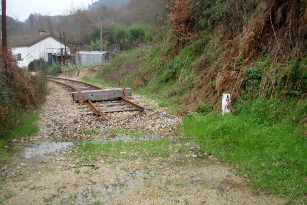
Tâmega Railway (between Livração and Amarante)

website: website: website: website: website: Owner/holder of the abandoned railway: IP Património/REFER Owner/holder of the abandoned railway: IP Património/REFER look at this now Owner/holder of the abandoned railway: Owner/holder of the abandoned railway: Owner/holder of the abandoned railway: Owner/holder of the abandoned railway: Owner/holder of the abandoned railway: IP Património/REFER IP Património/REFER IP Património/REFER IP Património/REFER IP Património/REFER gpx file: gpx file: gpx file: gpx file: gpx file: It’s a 12,77 Km railway in the valley of the Tâmega River, it was inaugurated in 1909 and crosses 6 villages till it finishes in the city of Amarante. This short railway has 3 bridges. It’s a 12,77 Km railway in the valley of the Tâmega River, it was inaugurated in 1909 and crosses 6 villages till it finishes in the city of Amarante. This short railway has 3 bridges. It’s a 12,77 Km railway in the valley of the Tâmega River, it was inaugurated in 1909 and crosses 6 villages till it finishes in the city of Amarante. This short railway has 3 bridges. It’s a 12,77 Km railway in the valley of the Tâmega River, it was inaugurated in 1909 and crosses 6 villages till it finishes in the city of Amarante. This short railway has 3 bridges. Total distance: 8646 mTotal climbing: 0 mTotal descent: -32 m Total distance: 8646 m Total distance: 8646 m Total climbing: 0 m Total climbing: 0 m Total descent: -32 m Total descent: -32 m All the villages have small buildings or small train stops, but the main station building it’s in the city of Amarante. From Amarante to Arco de Baúlhe – Cabeceiras de Basto, the greenway is already transformed (39 km).   https://www.ippatrimonio.pt/pt-pt/ecopistas-ip-patrimonio/ecopista-do-tamega Potential activities depend on the type of surface they can install on the ground. Potential users are pedestrians, runners and mountain bikers. If there is a plan for transforming this railway into a greenway, it’s not public yet. All the villages have small buildings or small train stops, but the main station building it’s in the city of Amarante. From Amarante to Arco de Baúlhe – Cabeceiras de Basto, the greenway is already transformed (39 km).   https://www.ippatrimonio.pt/pt-pt/ecopistas-ip-patrimonio/ecopista-do-tamega Potential activities depend on the type of surface they can install on the ground. Potential users are pedestrians, runners and mountain bikers. If there is a plan for transforming this railway into a greenway, it’s not public yet. All the villages have small buildings or small train stops, but the main station building it’s in the city of Amarante. From Amarante to Arco de Baúlhe – Cabeceiras de Basto, the greenway is already transformed (39 km).   https://www.ippatrimonio.pt/pt-pt/ecopistas-ip-patrimonio/ecopista-do-tamega Potential activities depend on the type of surface they can install on the ground. Potential users are pedestrians, runners and mountain bikers. If there is a plan for transforming this railway into a greenway, it’s not public yet. All the villages have small buildings or small train stops, but the main station building it’s in the city of Amarante. From Amarante to Arco de Baúlhe – Cabeceiras de Basto, the greenway is already transformed (39 km).   https://www.ippatrimonio.pt/pt-pt/ecopistas-ip-patrimonio/ecopista-do-tamega Potential activities depend on the type of surface they can install on the ground. Potential users are pedestrians, runners and mountain bikers. If there is a plan for transforming this railway into a greenway, it’s not public yet. All the villages have small buildings or small train stops, but the main station building it’s in the city of Amarante. From Amarante to Arco de Baúlhe – Cabeceiras de Basto, the greenway is already transformed (39 km).   https://www.ippatrimonio.pt/pt-pt/ecopistas-ip-patrimonio/ecopista-do-tamega All the villages have small buildings or small train stops, but the main station building it’s in the city of Amarante. From Amarante to Arco de Baúlhe – Cabeceiras de Basto, the greenway is already transformed (39 km).   https://www.ippatrimonio.pt/pt-pt/ecopistas-ip-patrimonio/ecopista-do-tamega All the villages have small buildings or small train stops, but the main station building it’s in the city of Amarante. All the villages have small buildings or small train stops, but the main station building it’s in the city of Amarante. From Amarante to Arco de Baúlhe – Cabeceiras de Basto, the greenway is already transformed (39 km).   https://www.ippatrimonio.pt/pt-pt/ecopistas-ip-patrimonio/ecopista-do-tamega From Amarante to Arco de Baúlhe – Cabeceiras de Basto, the greenway is already transformed (39 km).   https://www.ippatrimonio.pt/pt-pt/ecopistas-ip-patrimonio/ecopista-do-tamega Potential activities depend on the type of surface they can install on the ground. Potential activities depend on the type of surface they can install on the ground. Potential activities depend on the type of surface they can install on the ground. Potential activities depend on the type of surface they can install on the ground. Potential users are pedestrians, runners and mountain bikers. If there is a plan for transforming this railway into a greenway, it’s not public yet. Potential users are pedestrians, runners and mountain bikers. If there is a plan for transforming this railway into a greenway, it’s not public yet. Potential users are pedestrians, runners and mountain bikers. Potential users are pedestrians, runners and mountain bikers. If there is a plan for transforming this railway into a greenway, it’s not public yet. If there is a plan for transforming this railway into a greenway, it’s not public yet.

Tâmega Railway (between Livração and Amarante) Read More »

Tua Railway (from Carvalhais till the Tua Station)

website: website: website: website: website: Owner/holder of the abandoned railway: IP Património/REFER Owner/holder of the abandoned railway: IP Património/REFER Owner/holder of the abandoned railway: Owner/holder of the abandoned railway: Owner/holder of the abandoned railway: Owner/holder of the abandoned railway: Owner/holder of the abandoned railway: IP Património/REFER IP Património/REFER IP Património/REFER IP Património/REFER IP Património/REFER gpx file: gpx file: gpx file: gpx file: gpx file: This is a long railway with 58,138 Km, the region it’s Trás-os-Montes, and this is a mountain area with hills, cliffs, valleys and lots of tunnels and bridges. Most of the railway goes always near the Tua River till the place where the Tua River connects Douro River that follows across the Douro valley till the Atlantic Ocean in the city of Porto. This is a long railway with 58,138 Km, the region it’s Trás-os-Montes, and this is a mountain area with hills, cliffs, valleys and lots of tunnels and bridges. Most of the railway goes always near the Tua River till the place where the Tua River connects Douro River that follows across the Douro valley till the Atlantic Ocean in the city of Porto. This is a long railway with 58,138 Km, the region it’s Trás-os-Montes, and this is a mountain area with hills, cliffs, valleys and lots of tunnels and bridges. Most of the railway goes always near the Tua River till the place where the Tua River connects Douro River that follows across the Douro valley till the Atlantic Ocean in the city of Porto. This is a long railway with 58,138 Km, the region it’s Trás-os-Montes, and this is a mountain area with hills, cliffs, valleys and lots of tunnels and bridges. Most of the railway goes always near the Tua River till the place where the Tua River connects Douro River that follows across the Douro valley till the Atlantic Ocean in the city of Porto. Total distance: 39993 mTotal climbing: 5 mTotal descent: -139 m Total distance: 39993 m Total distance: 39993 m Total climbing: 5 m Total climbing: 5 m Total descent: -139 m Total descent: -139 m This 58,138 Km long railway has lots of small stations in almost all villages that are crossed by the railway, eg. the village of Carvalhais. The biggest and most beautiful train station it’s in the city of Mirandela. Credits: Portugal Ferroviário Considering the characteristics, the potential activities are cycling, walking, running and skating.   Credits: Duarte Belo Potential users are Pedestrians, Runners, Bikes and Mountain Bikes, Skaters or Roller Skaters. For the horse riders it will depend on the surface that they will put in the greenway in the future because a hard surface it will be bad of the horses. At this moment for this 58,138 Km there’s no known plan. This 58,138 Km long railway has lots of small stations in almost all villages that are crossed by the railway, eg. the village of Carvalhais. The biggest and most beautiful train station it’s in the city of Mirandela. Credits: Portugal Ferroviário Considering the characteristics, the potential activities are cycling, walking, running and skating.   Credits: Duarte Belo Potential users are Pedestrians, Runners, Bikes and Mountain Bikes, Skaters or Roller Skaters. For the horse riders it will depend on the surface that they will put in the greenway in the future because a hard surface it will be bad of the horses. At this moment for this 58,138 Km there’s no known plan. This 58,138 Km long railway has lots of small stations in almost all villages that are crossed by the railway, eg. the village of Carvalhais. The biggest and most beautiful train station it’s in the city of Mirandela. Credits: Portugal Ferroviário Considering the characteristics, the potential activities are cycling, walking, running and skating.   Credits: Duarte Belo Potential users are Pedestrians, Runners, Bikes and Mountain Bikes, Skaters or Roller Skaters. For the horse riders it will depend on the surface that they will put in the greenway in the future because a hard surface it will be bad of the horses. At this moment for this 58,138 Km there’s no known plan. This 58,138 Km long railway has lots of small stations in almost all villages that are crossed by the railway, eg. the village of Carvalhais. The biggest and most beautiful train station it’s in the city of Mirandela. Credits: Portugal Ferroviário Considering the characteristics, the potential activities are cycling, walking, running and skating.   Credits: Duarte Belo Potential users are Pedestrians, Runners, Bikes and Mountain Bikes, Skaters or Roller Skaters. For the horse riders it will depend on the surface that they will put in the greenway in the future because a hard surface it will be bad of the horses. At this moment for this 58,138 Km there’s no known plan. This 58,138 Km long railway has lots of small stations in almost all villages that are crossed by the railway, eg. the village of Carvalhais. The biggest and most beautiful train station it’s in the city of Mirandela. This 58,138 Km long railway has lots of small stations in almost all villages that are crossed by the railway, eg. the village of Carvalhais. The biggest and most beautiful train station it’s in the city of Mirandela. This 58,138 Km long railway has lots of small stations in almost all villages that are crossed by the railway, eg. the village of Carvalhais. The biggest and most beautiful train station it’s in the city of Mirandela. This 58,138 Km long railway has lots of small stations in almost all villages that are crossed by the railway, eg. the village of Carvalhais. The biggest and most beautiful train station it’s in the city of Mirandela. Credits: Portugal Ferroviário Credits: Portugal Ferroviário Credits: Portugal Ferroviário Credits: Portugal Ferroviário Credits: Portugal Ferroviário Credits: Portugal Ferroviário Credits: Portugal Ferroviário Credits: Portugal Ferroviário Considering the characteristics, the potential activities are cycling, walking, running and skating.   Considering the characteristics, the potential activities are cycling, walking, running and skating.

Tua Railway (from Carvalhais till the Tua Station) Read More »

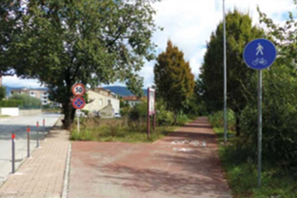
Ellera Corciano-Tavernelle Val Nestore Ex-railway

website: / website: / website: website: website: website: website: / / / / / Owner of the abandoned railway: Rete Ferroviaria Italiana (RFI) ( Italian railway infrastructure manager) Owner of the abandoned railway: Rete Ferroviaria Italiana (RFI) ( Italian railway infrastructure manager) Owner of the abandoned railway: Owner of the abandoned railway: Owner of the abandoned railway: Owner of the abandoned railway: Owner of the abandoned railway: Rete Ferroviaria Italiana (RFI) ( Italian railway infrastructure manager) Rete Ferroviaria Italiana (RFI) ( Italian railway infrastructure manager) Rete Ferroviaria Italiana (RFI) ( Italian railway infrastructure manager) Rete Ferroviaria Italiana (RFI) ( Italian railway infrastructure manager) Rete Ferroviaria Italiana (RFI) ( Italian railway infrastructure manager) gpx file: gpx file: gpx file: gpx file: gpx file: The Ellera-Tavernelle railway was single-track railway line that connected Ellera-Corciano station with Tavernelle, running for 21 km through the valley of the Nestore River. The line remained an isolated segment and was abandoned only 7 years after its activation. The railway track is characterized by short rectilinear sections with no particular difficulties. The original railway trackage has been almost completely dismantled. Many buildings and cantoniere houses have been sold to private individuals and local governments. The old path between the localities of Strozzacapponi and Capanne (3 km) has been converted into a greenway, by the realization of a bicycle and pedestrian path. In general local authorities show high interest in a potential re-use of the parts of the railway path still available. The ex railway line passed through the following municipalities: Ellera di Corciano, Marsciano, Piegaro and Panicale. Presence of 8 bridges. The Ellera-Tavernelle railway was single-track railway line that connected Ellera-Corciano station with Tavernelle, running for 21 km through the valley of the Nestore River. The line remained an isolated segment and was abandoned only 7 years after its activation. The railway track is characterized by short rectilinear sections with no particular difficulties. The original railway trackage has been almost completely dismantled. Many buildings and cantoniere houses have been sold to private individuals and local governments. The old path between the localities of Strozzacapponi and Capanne (3 km) has been converted into a greenway, by the realization of a bicycle and pedestrian path. In general local authorities show high interest in a potential re-use of the parts of the railway path still available. The ex railway line passed through the following municipalities: Ellera di Corciano, Marsciano, Piegaro and Panicale. Presence of 8 bridges. Total distance: 24548 mTotal climbing: 314 mTotal descent: -332 m Total distance: 24548 m Total distance: 24548 m Total climbing: 314 m Total climbing: 314 m Total descent: -332 m Total descent: -332 m The old railway crosses several villages. Visitors have the opportunity to extend their experience and visit more places: Corciano, a medieval hilltop town near Perugia, surrounded by nature and near Trasimeno Lake; Tavernelle with its buildings such as Madonna di Mongiovino Sanctuary and Collegiate Church of St. Michael; Castiglione della Valle that started out as a Benedictine monastery and then become a little village immersed in a sense of peace; Pietrafitta lake, an artificial lake, characterized by a rich fauna and archeology because of the numerous fossil remains found during the excavations. The lake has become a great attraction for hiking and fishing and it host the World carp fishing competition each year. Other relevant events : Umbria Jazz, that took place in Perugia in july; Corciano Festival that takes place in August and it is considered a small event dedicated to the visual arts, theater and music; Palio dei Somari, a little version of Siena Palio, but with donkeys that took place in Castiglione della Valle in September. The old railway crosses several villages. Visitors have the opportunity to extend their experience and visit more places: Corciano, a medieval hilltop town near Perugia, surrounded by nature and near Trasimeno Lake; Tavernelle with its buildings such as Madonna di Mongiovino Sanctuary and Collegiate Church of St. Michael; Castiglione della Valle that started out as a Benedictine monastery and then become a little village immersed in a sense of peace; Pietrafitta lake, an artificial lake, characterized by a rich fauna and archeology because of the numerous fossil remains found during the excavations. The lake has become a great attraction for hiking and fishing and it host the World carp fishing competition each year. Other relevant events : Umbria Jazz, that took place in Perugia in july; Corciano Festival that takes place in August and it is considered a small event dedicated to the visual arts, theater and music; Palio dei Somari, a little version of Siena Palio, but with donkeys that took place in Castiglione della Valle in September. The old railway crosses several villages. Visitors have the opportunity to extend their experience and visit more places: Corciano, a medieval hilltop town near Perugia, surrounded by nature and near Trasimeno Lake; Tavernelle with its buildings such as Madonna di Mongiovino Sanctuary and Collegiate Church of St. Michael; Castiglione della Valle that started out as a Benedictine monastery and then become a little village immersed in a sense of peace; Pietrafitta lake, an artificial lake, characterized by a rich fauna and archeology because of the numerous fossil remains found during the excavations. The lake has become a great attraction for hiking and fishing and it host the World carp fishing competition each year. Other relevant events : Umbria Jazz, that took place in Perugia in july; Corciano Festival that takes place in August and it is considered a small event dedicated to the visual arts, theater and music; Palio dei Somari, a little version of Siena Palio, but with donkeys that took place in Castiglione della Valle in September. Corciano Tavernelle Castiglione della Valle Pietrafitta lake The ex-railway could be suitable for a wide range of sports, such as cycling, running, walking and trekking. On the occasion of the 11th National Day of Ferrovie non Dimenticate, in 2018, many associations of the area organized the initiative Let’s Walk…Together. The event included

Ellera Corciano-Tavernelle Val Nestore Ex-railway Read More »

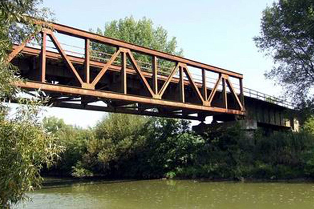
Lucca-Pontedera Bagni di Casciana ex-Railway

website: / website: / website: website: website: website: website: / / / / / Owner of the abandoned railway: Italian Railways of the State (Ferrovie dello Stato) Owner of the abandoned railway: Italian Railways of the State (Ferrovie dello Stato) Owner of the abandoned railway: Owner of the abandoned railway: Owner of the abandoned railway: Owner of the abandoned railway: Owner of the abandoned railway: Italian Railways of the State (Ferrovie dello Stato) Italian Railways of the State (Ferrovie dello Stato) Italian Railways of the State (Ferrovie dello Stato) Italian Railways of the State (Ferrovie dello Stato) Italian Railways of the State (Ferrovie dello Stato) gpx file: gpx file: gpx file: gpx file: gpx file: The Lucca – Pontedera ancient railway, a project of 25.3 km line long, was inaugurated in October 1928, after 6 years of works. During the Second World War the line was destroyed by bombing by the allies. Even if the line was largely rebuilt, in 1958 was officially abandoned. The track, generally covered by spontaneous vegetation, is not always visible. The line passed through the cities of: Lucca, Parezzana Toringo, San Leonardo-Sant’Andrea, San Ginese-Pieve di Compito, Colle di Compito,Buti-Cascine, Vicopisano-Bientina, Calcinaia, Pontedera. Many of the existing bridges have collapsed. In the old railway stations it is possible to admire several ruins, such as the Subalvea gallery, that passes under Visona Torrent. Near the city of Calcinaia, there is a bridge over the Arno river: 2 of 6 arches are still visible, the other 4 have been bombed. The third best-preserved work is a series of intersections near Via Pontemaggiore in San Leonardo in Treponzio: here there is an iron bridge over a river and a perfectly preserved arched bridge. The Lucca – Pontedera ancient railway, a project of 25.3 km line long, was inaugurated in October 1928, after 6 years of works. During the Second World War the line was destroyed by bombing by the allies. Even if the line was largely rebuilt, in 1958 was officially abandoned. The track, generally covered by spontaneous vegetation, is not always visible. The line passed through the cities of: Lucca, Parezzana Toringo, San Leonardo-Sant’Andrea, San Ginese-Pieve di Compito, Colle di Compito,Buti-Cascine, Vicopisano-Bientina, Calcinaia, Pontedera. Many of the existing bridges have collapsed. In the old railway stations it is possible to admire several ruins, such as the Subalvea gallery, that passes under Visona Torrent. Near the city of Calcinaia, there is a bridge over the Arno river: 2 of 6 arches are still visible, the other 4 have been bombed. The third best-preserved work is a series of intersections near Via Pontemaggiore in San Leonardo in Treponzio: here there is an iron bridge over a river and a perfectly preserved arched bridge. Total distance: 37548 mTotal climbing: 0 mTotal descent: 0 m Total distance: 37548 m Total distance: 37548 m Total climbing: 0 m Total climbing: 0 m Total descent: 0 m Total descent: 0 m The old abandoned railway passes through many interesting cities, among them: Lucca, one of the most fascinating and best-preserved mediaeval cities in Italy, Pontedera and Calcinaia, 2 small towns that are 3 km distant from each other; Vicopisano, Italian town located between the course of the Arno, famous for the Fortress of Brunelleschi; Medieval town Bientina. The most important festivals in the area are: Medieval Festival of Vicopisano, in September Lucca Comics, between October and November Palio Of Bientina, in July Another point of interest in the area is Lake Gherardesca, located in an area of Castelvecchio di Compito, in Capannori. The area of the lake is ideal for excursions, walks, birdwatching and nature photography. have a peek at these guys The old abandoned railway passes through many interesting cities, among them: Lucca, one of the most fascinating and best-preserved mediaeval cities in Italy, Pontedera and Calcinaia, 2 small towns that are 3 km distant from each other; Vicopisano, Italian town located between the course of the Arno, famous for the Fortress of Brunelleschi; Medieval town Bientina. The most important festivals in the area are: Medieval Festival of Vicopisano, in September Lucca Comics, between October and November Palio Of Bientina, in July Another point of interest in the area is Lake Gherardesca, located in an area of Castelvecchio di Compito, in Capannori. The area of the lake is ideal for excursions, walks, birdwatching and nature photography. Medieval Festival of Vicopisano, in September Lucca Comics, between October and November Palio Of Bientina, in July Medieval Festival of Vicopisano, in September Lucca Comics, between October and November Palio Of Bientina, in July Credits: Matteo Bini Credits: Matteo Bini Credits: Matteo Bini Credits: Matteo Bini Credits: Matteo Bini Credits: Matteo Bini Credits: Matteo Bini Credits: Matteo Bini The ex-railway could be suitable for carrying out plenty of sports and activities that can keep people entertained: Hiking, cycling, natural and educational excursions, walking and trekking and running, In the ecological reserve “Gherardesca’s lake, near Monte Pisano, some organizations organize trekking activities and walking routes to discover the biodiversity of the lake and the beauty of the area. The ex-railway could be suitable for carrying out plenty of sports and activities that can keep people entertained: Hiking, cycling, natural and educational excursions, walking and trekking and running, In the ecological reserve “Gherardesca’s lake, near Monte Pisano, some organizations organize trekking activities and walking routes to discover the biodiversity of the lake and the beauty of the area. Credits: Matteo Bini Credits: Matteo Bini Credits: Matteo Bini Credits: Matteo Bini According to the potential greenway project, pedestrians, bike and mountain bike will be able to use the track. The itinerary is quite easy and passes through secondary asphalt roads, dirt roads sometimes with uneven surface. For this reason, at the moment the track is not equipped for people with reduced mobility. The overall objective of the potential reconversion project Lucca-Pontedera tourist cycleway is the promotion of the Tuscan area and the connection between local businesses, gastronomic traditions and the environmental value. The goal of the project is the

Lucca-Pontedera Bagni di Casciana ex-Railway Read More »

Zlaté Moravce – Lužianky railway

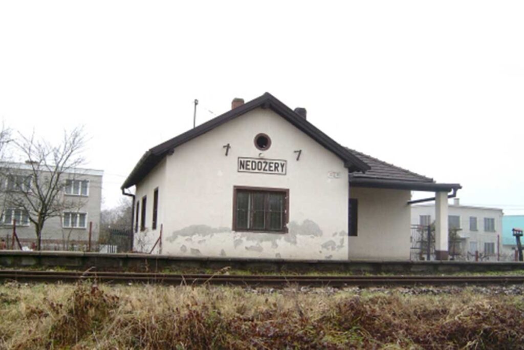
website: website: website: website: website: Owner of the abandoned railway: Slovak Republic Railways (Železnice Slovenskej republiky) Owner of the abandoned railway: Slovak Republic Railways (Železnice Slovenskej republiky) Owner of the abandoned railway: Owner of the abandoned railway: Owner of the abandoned railway: Owner of the abandoned railway: Owner of the abandoned railway: Slovak Republic Railways (Železnice Slovenskej republiky) Slovak Republic Railways (Železnice Slovenskej republiky) Slovak Republic Railways (Železnice Slovenskej republiky) Slovak Republic Railways (Železnice Slovenskej republiky) Slovak Republic Railways (Železnice Slovenskej republiky) gpx file: gpx file: gpx file: gpx file: gpx file: There are 6 stations between Lužianky and Zlaté Moravce (Drážovce, Podhorany, Žirany, Jelenec, Ladice, Sľažany). It simultaneously crosses the flat area of south Slovakia and also the hilly area of central Slovakia (Tribeč mountains). There are several bridges over the railway, viaducts on the rail too. There is a bridge over the river Nitra. There are 6 stations between Lužianky and Zlaté Moravce (Drážovce, Podhorany, Žirany, Jelenec, Ladice, Sľažany). It simultaneously crosses the flat area of south Slovakia and also the hilly area of central Slovakia (Tribeč mountains). There are several bridges over the railway, viaducts on the rail too. There is a bridge over the river Nitra. There are 6 stations between Lužianky and Zlaté Moravce (Drážovce, Podhorany, Žirany, Jelenec, Ladice, Sľažany). It simultaneously crosses the flat area of south Slovakia and also the hilly area of central Slovakia (Tribeč mountains). There are several bridges over the railway, viaducts on the rail too. There is a bridge over the river Nitra. There are 6 stations between Lužianky and Zlaté Moravce (Drážovce, Podhorany, Žirany, Jelenec, Ladice, Sľažany). It simultaneously crosses the flat area of south Slovakia and also the hilly area of central Slovakia (Tribeč mountains). There are several bridges over the railway, viaducts on the rail too. There is a bridge over the river Nitra. Total distance: 32231 mTotal climbing: 175 mTotal descent: -145 m Total distance: 32231 m Total distance: 32231 m Total climbing: 175 m Total climbing: 175 m Total descent: -145 m Total descent: -145 m Tribeč area offers many interesting hiking paths close to the city Nitra and can be accessible from the railway.  Tribeč is also very popular with mountain bikers since there are a lot of paths interweaving the hills. Intermodality: Lužianky station can be reached from Nitra by train and the train station is directly next to the bus station in Nitra. In Zlaté Moravce, stations are within 1,2 km from each other. Credits: https://kzmbojnice.railnet.sk/zastavka-nedozery-na-moduloch/ Considering the characteristics, the main activities are: cycling, walking, running, trekking, nordic walking, hiking, skating, mountain biking. Credits: https://kzmbojnice.railnet.sk/zastavka-nedozery-na-moduloch/ Since the railway is located in a flat area of the country mostly in a close proximity to the river Váh, it could be potentially visited by all people, even with reduced mobility. There is no steep incline and it should be accessible by anyone. There is no plan in action at the moment. Passenger transport was cancelled, it may still be used for cargo transport. Tribeč area offers many interesting hiking paths close to the city Nitra and can be accessible from the railway.  Tribeč is also very popular with mountain bikers since there are a lot of paths interweaving the hills. Intermodality: Lužianky station can be reached from Nitra by train and the train station is directly next to the bus station in Nitra. In Zlaté Moravce, stations are within 1,2 km from each other. Credits: https://kzmbojnice.railnet.sk/zastavka-nedozery-na-moduloch/ Considering the characteristics, the main activities are: cycling, walking, running, trekking, nordic walking, hiking, skating, mountain biking. Credits: https://kzmbojnice.railnet.sk/zastavka-nedozery-na-moduloch/ Since the railway is located in a flat area of the country mostly in a close proximity to the river Váh, it could be potentially visited by all people, even with reduced mobility. There is no steep incline and it should be accessible by anyone. There is no plan in action at the moment. Passenger transport was cancelled, it may still be used for cargo transport. Tribeč area offers many interesting hiking paths close to the city Nitra and can be accessible from the railway.  Tribeč is also very popular with mountain bikers since there are a lot of paths interweaving the hills. Intermodality: Lužianky station can be reached from Nitra by train and the train station is directly next to the bus station in Nitra. In Zlaté Moravce, stations are within 1,2 km from each other. Credits: https://kzmbojnice.railnet.sk/zastavka-nedozery-na-moduloch/ Considering the characteristics, the main activities are: cycling, walking, running, trekking, nordic walking, hiking, skating, mountain biking. Credits: https://kzmbojnice.railnet.sk/zastavka-nedozery-na-moduloch/ Since the railway is located in a flat area of the country mostly in a close proximity to the river Váh, it could be potentially visited by all people, even with reduced mobility. There is no steep incline and it should be accessible by anyone. There is no plan in action at the moment. Passenger transport was cancelled, it may still be used for cargo transport. Tribeč area offers many interesting hiking paths close to the city Nitra and can be accessible from the railway.  Tribeč is also very popular with mountain bikers since there are a lot of paths interweaving the hills. Intermodality: Lužianky station can be reached from Nitra by train and the train station is directly next to the bus station in Nitra. In Zlaté Moravce, stations are within 1,2 km from each other. Credits: https://kzmbojnice.railnet.sk/zastavka-nedozery-na-moduloch/ Considering the characteristics, the main activities are: cycling, walking, running, trekking, nordic walking, hiking, skating, mountain biking. Credits: https://kzmbojnice.railnet.sk/zastavka-nedozery-na-moduloch/ Since the railway is located in a flat area of the country mostly in a close proximity to the river Váh, it could be potentially visited by all people, even with reduced mobility. There is no steep incline and it should be accessible by anyone. There is no plan in action at the moment. Passenger transport was cancelled, it may still be used for cargo transport. Tribeč area offers many interesting hiking paths close to the city Nitra and can be accessible from the railway.  Tribeč is also very popular with

Zlaté Moravce – Lužianky railway Read More »

Nitrianske Pravno – Prievidza Railway

website: website: website: website: website: Owner of the abandoned railway: Slovak Republic Railways (Železnice Slovenskej republiky) Owner of the abandoned railway: Slovak Republic Railways (Železnice Slovenskej republiky) Owner of the abandoned railway: Owner of the abandoned railway: Owner of the abandoned railway: Owner of the abandoned railway: Owner of the abandoned railway: Slovak Republic Railways (Železnice Slovenskej republiky) Slovak Republic Railways (Železnice Slovenskej republiky) Slovak Republic Railways (Železnice Slovenskej republiky) Slovak Republic Railways (Železnice Slovenskej republiky) Slovak Republic Railways (Železnice Slovenskej republiky) . gpx file: gpx file: gpx file: gpx file: gpx file: The majority of the railway passes fields and a flat area of the country. Besides Nitrianske Pravno and Prievidza, it crossed only two other municipalities with stations in Nedožery any Pravenec. There is a tunnel over river Nitra near Pravenec village. The majority of the railway passes fields and a flat area of the country. Besides Nitrianske Pravno and Prievidza, it crossed only two other municipalities with stations in Nedožery any Pravenec. There is a tunnel over river Nitra near Pravenec village. The majority of the railway passes fields and a flat area of the country. Besides Nitrianske Pravno and Prievidza, it crossed only two other municipalities with stations in Nedožery any Pravenec. There is a tunnel over river Nitra near Pravenec village. The majority of the railway passes fields and a flat area of the country. Besides Nitrianske Pravno and Prievidza, it crossed only two other municipalities with stations in Nedožery any Pravenec. There is a tunnel over river Nitra near Pravenec village. Total distance: 10272 mTotal climbing: 78 mTotal descent: -2 m Total distance: 10272 m Total distance: 10272 m Total climbing: 78 m Total climbing: 78 m Total descent: -2 m Total descent: -2 m Intermodality: Bus station in Prievidza is located next to the train station and in Nitrianske Pravno, the distance from the bus stop is only 8 minutes on foot (750 m). There are a couple cycling paths crossing Nitrianske Pravno which can be easily accessed (Bojnický cyklookruh, Pravnianska radiála, Ponitrianska cyklomagistrála II. In Prievidza, people can visit the Motive power depot, which was marked as a national cultural monument. It is the most preserved depot in Slovakia with exhibitions of original technical equipment. Intermodality: Bus station in Prievidza is located next to the train station and in Nitrianske Pravno, the distance from the bus stop is only 8 minutes on foot (750 m). There are a couple cycling paths crossing Nitrianske Pravno which can be easily accessed (Bojnický cyklookruh, Pravnianska radiála, Ponitrianska cyklomagistrála II. In Prievidza, people can visit the Motive power depot, which was marked as a national cultural monument. It is the most preserved depot in Slovakia with exhibitions of original technical equipment. Intermodality: Bus station in Prievidza is located next to the train station and in Nitrianske Pravno, the distance from the bus stop is only 8 minutes on foot (750 m). Intermodality: Bus station in Prievidza is located next to the train station and in Nitrianske Pravno, the distance from the bus stop is only 8 minutes on foot (750 m). There are a couple cycling paths crossing Nitrianske Pravno which can be easily accessed (Bojnický cyklookruh, Pravnianska radiála, Ponitrianska cyklomagistrála II. There are a couple cycling paths crossing Nitrianske Pravno which can be easily accessed (Bojnický cyklookruh, Pravnianska radiála, Ponitrianska cyklomagistrála II. In Prievidza, people can visit the Motive power depot, which was marked as a national cultural monument. It is the most preserved depot in Slovakia with exhibitions of original technical equipment. In Prievidza, people can visit the Motive power depot, which was marked as a national cultural monument. It is the most preserved depot in Slovakia with exhibitions of original technical equipment. Considering the characteristics, the main activities are: cycling, walking, running, trekking, nordic walking, hiking, skating. Considering the characteristics, the main activities are: cycling, walking, running, trekking, nordic walking, hiking, skating. Considering the characteristics, the main activities are: cycling, walking, running, trekking, nordic walking, hiking, skating. Considering the characteristics, the main activities are: cycling, walking, running, trekking, nordic walking, hiking, skating. Since the railway is located in a flat area of the country, it could be potentially visited by all people, even with reduced mobility. There is no steep incline and it should be accessible by anyone. At the moment, passenger transportation is cancelled on the railway but very rarely it is used to access the quarry in Žirany. No greenway conversion action plan is in place. Since the railway is located in a flat area of the country, it could be potentially visited by all people, even with reduced mobility. There is no steep incline and it should be accessible by anyone. At the moment, passenger transportation is cancelled on the railway but very rarely it is used to access the quarry in Žirany. No greenway conversion action plan is in place. Since the railway is located in a flat area of the country, it could be potentially visited by all people, even with reduced mobility. There is no steep incline and it should be accessible by anyone. Since the railway is located in a flat area of the country, it could be potentially visited by all people, even with reduced mobility. There is no steep incline and it should be accessible by anyone. At the moment, passenger transportation is cancelled on the railway but very rarely it is used to access the quarry in Žirany. No greenway conversion action plan is in place. At the moment, passenger transportation is cancelled on the railway but very rarely it is used to access the quarry in Žirany. No greenway conversion action plan is in place.

Nitrianske Pravno – Prievidza Railway Read More »

Komárno – Kolárovo railway

website: website: website: website: website: Owner of the abandoned railway: Slovak Republic Railways (Železnice Slovenskej republiky) Owner of the abandoned railway: Slovak Republic Railways (Železnice Slovenskej republiky) view details Owner of the abandoned railway: Owner of the abandoned railway: Owner of the abandoned railway: Owner of the abandoned railway: Owner of the abandoned railway: Slovak Republic Railways (Železnice Slovenskej republiky) Slovak Republic Railways (Železnice Slovenskej republiky) Slovak Republic Railways (Železnice Slovenskej republiky) Slovak Republic Railways (Železnice Slovenskej republiky) Slovak Republic Railways (Železnice Slovenskej republiky) gpx file: gpx file: gpx file: gpx file: gpx file: The old railway passes through the southern region of Slovakia and is surrounded by vegetation and fields. River Váh flows in a close proximity to the railway with its tributaries. The railway passes 7 stations between Komárno and Kolárovo (Komárno school, Hadovce, Kameničná, Balvany, Čalovec, Violín, Kráľka). There is a bridge that crosses the Komárňanský Cannal and part of the railway goes alongside a small nature reserve SEV Dropie. Another bridge crosses the Kolárovo-Kameničná stream between Čalovec and Balvany stations. The old railway passes through the southern region of Slovakia and is surrounded by vegetation and fields. River Váh flows in a close proximity to the railway with its tributaries. The railway passes 7 stations between Komárno and Kolárovo (Komárno school, Hadovce, Kameničná, Balvany, Čalovec, Violín, Kráľka). There is a bridge that crosses the Komárňanský Cannal and part of the railway goes alongside a small nature reserve SEV Dropie. Another bridge crosses the Kolárovo-Kameničná stream between Čalovec and Balvany stations. The old railway passes through the southern region of Slovakia and is surrounded by vegetation and fields. River Váh flows in a close proximity to the railway with its tributaries. The railway passes 7 stations between Komárno and Kolárovo (Komárno school, Hadovce, Kameničná, Balvany, Čalovec, Violín, Kráľka). There is a bridge that crosses the Komárňanský Cannal and part of the railway goes alongside a small nature reserve SEV Dropie. Another bridge crosses the Kolárovo-Kameničná stream between Čalovec and Balvany stations. The old railway passes through the southern region of Slovakia and is surrounded by vegetation and fields. River Váh flows in a close proximity to the railway with its tributaries. The railway passes 7 stations between Komárno and Kolárovo (Komárno school, Hadovce, Kameničná, Balvany, Čalovec, Violín, Kráľka). There is a bridge that crosses the Komárňanský Cannal and part of the railway goes alongside a small nature reserve SEV Dropie. Another bridge crosses the Kolárovo-Kameničná stream between Čalovec and Balvany stations. Total distance: 25849 mTotal climbing: 21 mTotal descent: -25 m Total distance: 25849 m Total distance: 25849 m Total climbing: 21 m Total climbing: 21 m Total descent: -25 m Total descent: -25 m Near Kolárovo, there are old water mills which have been transformed into a Museum of windmills (Múzeum vodného mlynárstva, Lodný mlyn Kolárovo). Part of the railway goes alongside a small nature reserve SEV Dropie.  There already exists one cycle route between those two towns and the municipalities, but this path goes along the river Váh from the other side of the river. Intermodality: Bus station Komárno is located right next to the train station which makes transport to and from the railway very convenient. In Kolárovo, the bus station in app. 1,2 km from the train station and it is possible to reach it on foot. Near Kolárovo, there are old water mills which have been transformed into a Museum of windmills (Múzeum vodného mlynárstva, Lodný mlyn Kolárovo). Part of the railway goes alongside a small nature reserve SEV Dropie.  There already exists one cycle route between those two towns and the municipalities, but this path goes along the river Váh from the other side of the river. Intermodality: Bus station Komárno is located right next to the train station which makes transport to and from the railway very convenient. In Kolárovo, the bus station in app. 1,2 km from the train station and it is possible to reach it on foot. Near Kolárovo, there are old water mills which have been transformed into a Museum of windmills (Múzeum vodného mlynárstva, Lodný mlyn Kolárovo). Part of the railway goes alongside a small nature reserve SEV Dropie.  Near Kolárovo, there are old water mills which have been transformed into a Museum of windmills (Múzeum vodného mlynárstva, Lodný mlyn Kolárovo). Part of the railway goes alongside a small nature reserve SEV Dropie.  There already exists one cycle route between those two towns and the municipalities, but this path goes along the river Váh from the other side of the river. There already exists one cycle route between those two towns and the municipalities, but this path goes along the river Váh from the other side of the river. Intermodality: Intermodality: Bus station Komárno is located right next to the train station which makes transport to and from the railway very convenient. In Kolárovo, the bus station in app. 1,2 km from the train station and it is possible to reach it on foot. Bus station Komárno is located right next to the train station which makes transport to and from the railway very convenient. In Kolárovo, the bus station in app. 1,2 km from the train station and it is possible to reach it on foot. Considering the characteristics, the main activities are: cycling, walking, running, trekking, nordic walking, hiking, skating. Considering the characteristics, the main activities are: cycling, walking, running, trekking, nordic walking, hiking, skating. Considering the characteristics, the main activities are: cycling, walking, running, trekking, nordic walking, hiking, skating. Considering the characteristics, the main activities are: c ycling, walking, running, trekking, nordic walking, hiking, skating. Since the railway is located in a flat area of the country, it could be potentially visited by all people, even with reduced mobility. There is no steep incline and it should be accessible by anyone. At the moment, there is no effective plan for transforming this abandoned railway into a GW., since there is already an existing cycling path between Komárno and Kolárovo, on the

Komárno – Kolárovo railway Read More »

Pre-RAVeL of Line 618. From Assenois (Vaux-sur-Sûre) to Martelange

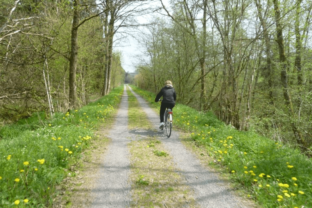
website: website: website: website: website: Owner/holder of the abandoned railway: The general legal framework in the Walloon Region is an emphyteutic lease between Wallonia and the SNCB, allowing the Walloon Region to use the former railways to develop greenways Owner/holder of the abandoned railway: The general legal framework in the Walloon Region is an emphyteutic lease between Wallonia and the SNCB, allowing the Walloon Region to use the former railways to develop greenways Owner/holder of the abandoned railway: Owner/holder of the abandoned railway: Owner/holder of the abandoned railway: more helpful hints Owner/holder of the abandoned railway: Owner/holder of the abandoned railway: The general legal framework in the Walloon Region is an emphyteutic lease between Wallonia and the SNCB, allowing the Walloon Region to use the former railways to develop greenways The general legal framework in the Walloon Region is an emphyteutic lease between Wallonia and the SNCB, allowing the Walloon Region to use the former railways to develop greenways The general legal framework in the Walloon Region is an emphyteutic lease between Wallonia and the SNCB, allowing the Walloon Region to use the former railways to develop greenways The general legal framework in the Walloon Region is an emphyteutic lease between Wallonia and the SNCB, allowing the Walloon Region to use the former railways to develop greenways The general legal framework in the Walloon Region is an emphyteutic lease between Wallonia and the SNCB, allowing the Walloon Region to use the former railways to develop greenways gpx file: gpx file: gpx file: gpx file: gpx file: This itinerary follows the old vicinal line 618, today developed into a pre-RAVeL between Assenois, the ponds of the Strange in Hompré and Martelange, in the province of Luxemburg in Begium, region of the Ardennes The “Pre-Ravel” goes through many villages in the Bastogne region, in the calm and idyllic setting of the Strange and Sûre valleys. It runs along the edge of the Strange ponds, between Hompré and Hollange, and will link its course to the meandering of the Sure river. Most of the route is in the Natura 2000 area, and the surrounding nature invites to enjoy outdoor and take a discovering and leisurely walk. Multiple educational totems along the way remind the origin of the line. On the territory of the municipality of Fauvillers, metal panels “Mémoire du Tram”, in the shape of the front of a locomotive, give the names of the old stops and local and historical information. This itinerary follows the old vicinal line 618, today developed into a pre-RAVeL between Assenois, the ponds of the Strange in Hompré and Martelange, in the province of Luxemburg in Begium, region of the Ardennes The “Pre-Ravel” goes through many villages in the Bastogne region, in the calm and idyllic setting of the Strange and Sûre valleys. It runs along the edge of the Strange ponds, between Hompré and Hollange, and will link its course to the meandering of the Sure river. Most of the route is in the Natura 2000 area, and the surrounding nature invites to enjoy outdoor and take a discovering and leisurely walk. Multiple educational totems along the way remind the origin of the line. On the territory of the municipality of Fauvillers, metal panels “Mémoire du Tram”, in the shape of the front of a locomotive, give the names of the old stops and local and historical information. Total distance: 21316 mTotal climbing: 556 mTotal descent: -436 m Total distance: 21316 m Total distance: 21316 m Total climbing: 556 m Total climbing: 556 m Total descent: -436 m Total descent: -436 m Very good connexions with sports equipment’s, namely the sports hall in Martelange is right nearby. Great diversity of natural and cultural assets, the greenway crosses a very beautiful & historically valuable rural area, the Ardennes region. It is right on the border of Luxembourg, which gives it a cross-border interest. Parc de la Haute-Sure/Foret d’Anlier: the area around the Maison du Parc invites to discover local ecosystems: signposted walks, recreational facilities, including the “bird walk” & the “biodiversity labyrinth Ardoise Museum Haut-Martelange: provides a complete overview of a mining industry that has shaped the region for 200 years. Bastogne War Museum. The main World War II memorial site in Belgium, with a focus on the Battle of the Ardennes. Considering the characteristics, the main activities are: c Potential users are cyclists, walkers, horse riders and; no information about people with reduced mobility. The route is already developed as Pre-Ravel. Improvement works are planned: development of the RAVeL between Radelange and Martelange (1 km). Stage: award of works. Potential users are cyclists, walkers, horse riders and; no information about people with reduced mobility. The route is already developed as Pre-Ravel. Improvement works are planned: development of the RAVeL between Radelange and Martelange (1 km). Stage: award of works. Potential users are cyclists, walkers, horse riders and; no information about people with reduced mobility. Potential users are c The route is already developed as Pre-Ravel. Improvement works are planned: development of the RAVeL between Radelange and Martelange (1 km). Stage: award of works.

Pre-RAVeL of Line 618. From Assenois (Vaux-sur-Sûre) to Martelange Read More »

Lines 107 & 114 La Louvière station –Central Channel

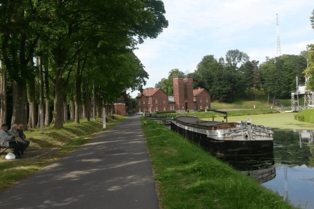
website: / website: / website: website: website: website: offers on website: / / / / / Owner/holder of the abandoned railway: The general legal framework in the Walloon Region is an emphyteutic lease between Wallonia and the SNCB, allowing the Walloon Region to use the former railways to develop greenways Owner/holder of the abandoned railway: The general legal framework in the Walloon Region is an emphyteutic lease between Wallonia and the SNCB, allowing the Walloon Region to use the former railways to develop greenways Owner/holder of the abandoned railway: Owner/holder of the abandoned railway: Owner/holder of the abandoned railway: Owner/holder of the abandoned railway: Owner/holder of the abandoned railway: The general legal framework in the Walloon Region is an emphyteutic lease between Wallonia and the SNCB, allowing the Walloon Region to use the former railways to develop greenways The general legal framework in the Walloon Region is an emphyteutic lease between Wallonia and the SNCB, allowing the Walloon Region to use the former railways to develop greenways The general legal framework in the Walloon Region is an emphyteutic lease between Wallonia and the SNCB, allowing the Walloon Region to use the former railways to develop greenways The general legal framework in the Walloon Region is an emphyteutic lease between Wallonia and the SNCB, allowing the Walloon Region to use the former railways to develop greenways The general legal framework in the Walloon Region is an emphyteutic lease between Wallonia and the SNCB, allowing the Walloon Region to use the former railways to develop greenways gpx file: gpx file: gpx file: gpx file: gpx file: Total distance: 0 mTotal climbing: 0 mTotal descent: 0 m Total distance: 0 m Total distance: 0 m Total climbing: 0 m Total climbing: 0 m Total descent: 0 m Total descent: 0 m This greenway will allow to stablish a connexion with shops and sports centres. This will be a regional interchange node (train and bus station); a link with the schools will also be established. The Four Lifts on the Canal du Centre and their Environs, La Louvière and Le Roeulx (Hainaut) are a UNESCO World Heritage Site. The four hydraulic boat-lifts together with the canal itself and its associated structures, constitute a remarkably well-preserved and complete example of a late-19th-century industrial landscape. Located over a distance of 7 km, each one covering a change in level of 15 to 16 meters. They are the only ones in the world which still exist in their original working condition. Credits: EGWA Credits: EGWA Credits: EGWA Credits: EGWA Credits: EGWA Credits: EGWA Credits: EGWA Credits: EGWA Considering the characteristics, the main activities are: cycling, walking, jogging, horse riding, Considering the characteristics, the main activities are: cycling, walking, jogging, horse riding, Considering the characteristics, the main activities are: cycling, walking, jogging, horse riding, Considering the characteristics, the main activities are: c ycling, walking, jogging, horse riding, Credits: Walloon Region Credits: Walloon Region Credits: Walloon Region Credits: Walloon Region The potential users are cyclists, walkers, horse riders and, most likely, people with reduced mobility (to be confirmed upon completion of the pre-study), as usual  in the RAVel  -greenways.  There is a plan by Walloon Region for transforming this abandoned railway into a greenway. Stage: pre-study. The potential users are cyclists, walkers, horse riders and, most likely, people with reduced mobility (to be confirmed upon completion of the pre-study), as usual  in the RAVel  -greenways.  There is a plan by Walloon Region for transforming this abandoned railway into a greenway. Stage: pre-study. The potential users are cyclists, walkers, horse riders and, most likely, people with reduced mobility (to be confirmed upon completion of the pre-study), as usual  in the RAVel  -greenways.  The potential users are There is a plan by Walloon Region for transforming this abandoned railway into a greenway. Stage: pre-study. There is a plan by Walloon Region for transforming this abandoned railway into a greenway. Stage: pre-study.

Lines 107 & 114 La Louvière station –Central Channel Read More »